14-Day Grand Xinjiang Itinerary: North Lakes, South Silk Road, and the Pamir
The distances, drive times, and opening notes below reflect what published schedules state and what travelers report, and they should be reconfirmed before booking. Use the plan as a framework, not as a diary of a journey taken.
A quick orientation
The route connects the alpine north of Xinjiang with the desert Silk Road of the south and ends on the high Pamir Plateau. Published itineraries consistently group these three zones into a single long loop because the main rail and road arteries link them through Urumqi in the center. Geographically, the loop forms a rough triangle: the northern apex runs along the Tianshan range and the Altai foothills near the Kazakh, Russian, and Mongolian borders; the southern base stretches along the Tarim Basin beneath the Taklamakan Desert; and the western spur climbs into the Pamir where the Tianshan, Karakoram, and Hindu Kush systems meet near the borders of Tajikistan, Afghanistan, Pakistan, and Kyrgyzstan. Travelers report that 14 days is the practical minimum to cover all three without cutting the Pamir short.
Logistically, the three zones behave very differently. The north is wetter, greener, and more spread out, with lake and grassland destinations that sit hours apart by road and depend heavily on a private car or a timed shuttle. The south is drier and more linear, following the historical oasis chain along the northern edge of the Taklamakan, where trains and flights connect the main towns and distances between sites are shorter. The Pamir is the most remote of the three: a single mountain corridor from Kashgar to Tashkurgan, with limited fuel, food, and lodging, and a mandatory border permit. Most published plans bridge the north and south with a flight or a long train rather than a direct cross-desert drive, which is why the timetable below folds the Urumqi-to-Kashgar hop into flight or rail legs.
| Item | Detail |
|---|---|
| Total loop distance | About 4,500 to 5,200 km by road, depending on detours |
| Main regions | North lakes (Tianshan, Kanas, Ili), South Silk Road (Turpan, Kuqa, Kashgar), Pamir (Tashkurgan) |
| Start and end | Urumqi Diwopu International Airport (URC) |
| Transport mix | Domestic flights, trains, and private car or rental |
| Top elevation | Karakul Lake area around 3,600 m; Tashkurgan around 3,100 m |
| Border permit | Required for Tashkurgan and the Pamir; obtained in Kashgar per published procedure |
For a shorter version focused on two zones, see the 10-day itinerary.
Roads, signposts and distances
Most travelers arrive at Urumqi Diwopu International Airport, which published schedules list with direct flights from major Chinese hubs and regional connections. Urumqi sits roughly in the geographic center of the region, which makes it the natural hinge for a loop: every leg of the plan either starts from it, returns to it, or passes near it by rail. From Urumqi the loop branches north by rail and road to Heavenly Lake, then on to the Ili Valley, and south by rail or flight to Turpan, Kuqa, and Kashgar. The southern leg from Kashgar to Tashkurgan is a mountain drive on the Karakoram Highway corridor.
On the northern branch, the standard published approach is to leave Urumqi by car or bus for Heavenly Lake (about a two-hour transfer including the mandatory park shuttle), then continue northwest toward the Ili Valley the following day. The Ili leg is long and scenic, crossing the Tianshan via passes that travelers describe as a full day of driving with a midway overnight in Kuitun or Shihezi. From Yining, the far west of the north zone, the loop reaches Nalati grassland before cutting back east and north toward the Altai and Kanas. That return east is the reason the timetable uses a flight or a long drive on Day 6: the straight-line distance between the Ili Valley and the Altai is deceptively large once you account for the Tianshan lying between them.
On the southern branch, published schedules show frequent daytime and overnight trains from Urumqi to Turpan (under two hours by high-speed rail) and onward to Kuqa and Kashgar, with the full Urumqi-to-Kashgar rail span running closer to a full day or a booked overnight sleeper. Flights on the same corridor are faster but pricier and more weather-sensitive. The final mountain segment, Kashgar to Tashkurgan, is not served by rail; it is a road-only drive of several hours on the Karakoram Highway, and travelers report that the last fuel and full-service supplies before the Pamir are in Kashgar, so the Day 12 permit stop doubles as a provisioning stop.
Travelers report that a common efficient pattern is to fly into Urumqi, take the train north, and fly back from Kashgar to Urumqi at the end to save a long return drive. Details on rail options are in the Silk Road train travel guide. For self-drive planning, read renting a car. Start your layover with the Urumqi city guide.
Entry fees
Published schedules and traveler reports put the main fixed costs into parks, trains, and flights. The biggest single variable is the flight between Urumqi and Kashgar: travelers report that the same seat can swing from about CNY 600 in the shoulder season to more than CNY 1,400 in July and August, and that booking two to four weeks ahead tends to beat walk-up pricing. Trains are the cheaper backbone, with a north-line soft sleeper commonly quoted in the CNY 200 to 500 band depending on distance and class, but the popular overnight routes sell out first in summer, so the earlier you lock the berth the better the choice of departure.
Park fees are the other fixed block. Heavenly Lake is essentially a gate plus a mandatory shuttle, so the CNY 100 to 215 range already assumes you ride the bus up from the parking area rather than walking. Kanas and Hemu are priced as a combined area ticket with internal shuttles, and travelers report that the shuttle is not optional once you are inside the reserve, which is why the CNY 300 to 400 figure is the realistic floor rather than a budget option. Smaller south-zone sites such as Turpan’s ruins and Kuqa’s grottoes typically carry their own modest entry fees that add up across the day but stay well below the alpine parks. The Pamir border permit itself is free, but the drive consumes fuel, a possible hired 4WD or driver, and meals in Tashkurgan.
A comparison of the typical booking items:
| Cost item | Typical range (per person) | Booking note |
|---|---|---|
| Heavenly Lake entry + shuttle | CNY 100 to 215 | Buy at the gate or official platform |
| Kanas + Hemu combined ticket | CNY 300 to 400 with shuttles | Seasonal price varies |
| Urumqi to Kashgar flight | CNY 600 to 1,400 | Cheaper off peak |
| Train north (soft sleeper) | CNY 200 to 500 | Book ahead in summer |
| Pamir border permit | Free | Process in Kashgar with passport |
For a full breakdown of daily spend and saving tactics, see Xinjiang on a budget. Note that park shuttles are mandatory inside Kanas and Heavenly Lake, so the shuttle fee is not optional. Travelers also note that accommodation in Hemu and Kanas carries a peak-season premium that can rival the park tickets, so the per-person daily total in the north is usually higher than in the south.
What each season brings
Published seasonal guides state that June through September is the standard window for this loop because the Ili apricot blossoms, alpine lakes, and Pamir passes are all accessible. Travelers report that July and August are the busiest and most expensive, while September gives cooler weather and golden birch in Hemu. The north and the Pamir do not peak at exactly the same moment, so a late-summer departure is a common compromise that catches both.
The south is the most heat-tolerant part of the loop and also the most heat-extreme: Turpan is one of the hottest low points in the region, so travelers schedule its ruins for early morning and late afternoon rather than midday in July and August. The Pamir, by contrast, stays cool even in summer, and its constraint is less season than altitude and occasional road closure from weather, which is why the loop keeps a buffer day at the end. Winter closes some high passes and reduces services, described in Xinjiang in winter.
The full seasonal logic is in the best time to visit guide. For the Pamir specifically, altitude and cold matter more than season, covered under altitude sickness on the Pamir.
The itinerary I would follow
The timetable below is a realistic 14-day loop based on published drive times and traveler reports. Day numbers are sequential, with rest built in on travel days. The pacing assumes you treat the long transfer days as light days and concentrate sightseeing on the base-town mornings, which is the pattern travelers report works best against the region’s size.
| Day | Base | Plan |
|---|---|---|
| 1 | Urumqi | Arrive, pick up car or rest, city walk, prep Pamir permit documents |
| 2 | Urumqi / Heavenly Lake | Day trip to Heavenly Lake, return to Urumqi |
| 3 | Kuitun or Shihezi | Drive north toward Ili, overnight midway |
| 4 | Yining | Explore Yining and the Ili Valley, local bazaar |
| 5 | Nalati | Drive to Nalati grassland, alpine meadow walk |
| 6 | Yining / flight north | Return to Yining, fly or drive to Urumqi, connect to north Altai route |
| 7 | Kanas | Reach Kanas Lake, lakeside boardwalk |
| 8 | Hemu | Transfer to Hemu Village, birch forest and wooden cabins |
| 9 | Urumqi (flight) | Fly back south, overnight in Urumqi or take night train |
| 10 | Turpan | Visit Turpan oasis and ruins |
| 11 | Kuqa | Train or drive to Kuqa, Southern Silk Road sites |
| 12 | Kashgar | Reach Kashgar, process Pamir border permit, Kashgar Old Town |
| 13 | Tashkurgan / Pamir | Pamir Plateau drive, Karakul Lake at Muztagh Ata |
| 14 | Kashgar / fly out | Return to Kashgar, fly to Urumqi and depart |

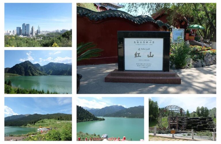
The Tianshan corridor above is the northern anchor of the loop on Day 2, where the road climbs from the dry foothills into a band of spruce and alpine water that travelers describe as the clearest visual break between the desert basin and the green north.
Where to sleep
Accommodation follows the base towns in the timetable. Travelers report that Hemu and Kanas have limited rooms in peak season, so booking ahead is standard. Kashgar and Urumqi have the widest range, from international hotels to guesthouses, and both also serve as the logical places to spend a little more on a comfortable night before or after a long transfer. The mid-size towns of Yining, Turpan, and Kuqa sit in between, flexible enough in supply but not to be ignored in summer.
The one genuine lodging squeeze on the loop is the Pamir. Tashkurgan has a small stock of hotels and guesthouses, and the Karakul Lake area has even fewer, so travelers who want to stay close to the lake usually arrange it as part of a packaged Pamir drive rather than walk-up. Planning the overnight for Day 13 in advance is the norm, and travelers report that the altitude makes a quiet, warm room more valuable than usual, which is another reason the packing list below matters.
For the full regional list see where to stay.

Yining on Day 4 is a comfortable mid range base with good hotel supply, set in river-fed green country that travelers use as a recuperation point before the longer Altai drive.
What & Where to Eat Nearby
Each base town has a signature dish. In Urumqi and Turpan travelers point to Da Pan Ji (big plate chicken), a stew served over hand-pulled noodles that travelers describe as the reliable group meal after a long drive. Across the region lamb skewers are common at night markets, and polao is a standard lunch, the kind of rice-and-raisin plate found at almost any roadside stop from Ili to Kashgar. The Ili and Turpan areas are known for fruits and melons, especially in late summer, when travelers report that the roadside grapes and melons are both cheap and a useful counter to the dry heat.
On the Pamir the menu narrows. Travelers report that Tashkurgan and the Karakul area lean on noodles, bread, and simple meat dishes, with fewer fresh vegetables than the north, so the Ili fruit bought earlier in the trip doubles as a snack reserve. Keeping a small stash of snacks and water for the Day 13 drive is a point several traveler reports make, because roadside options thin out above the tree line.

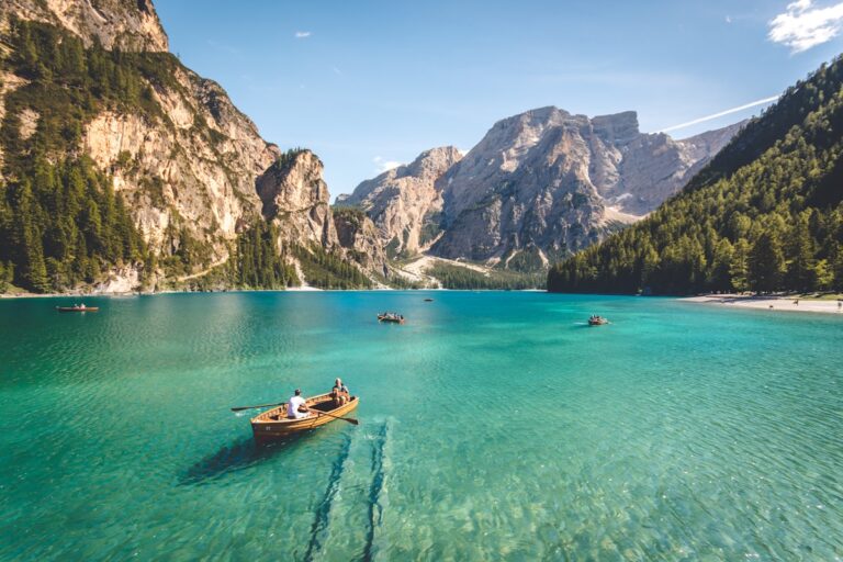
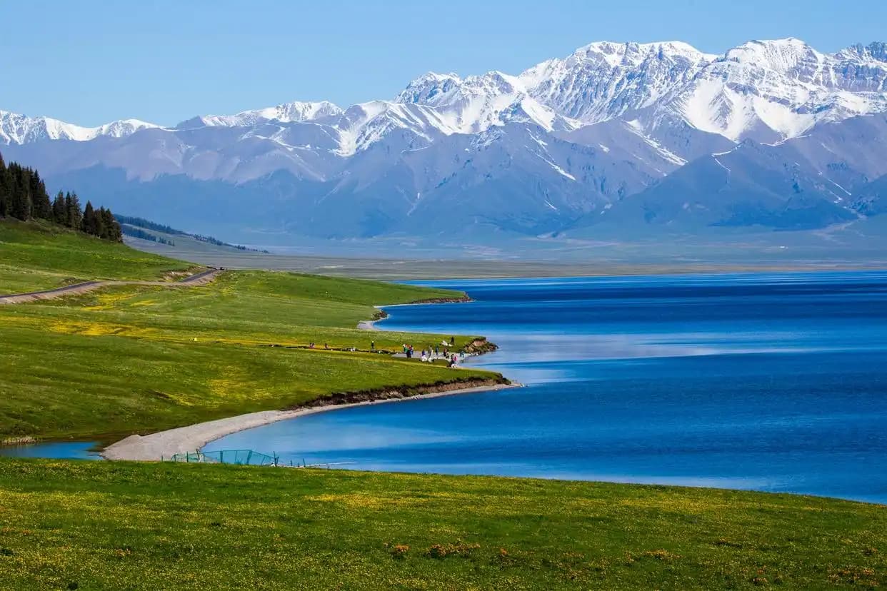
Sayram Lake sits near the Ili route and is a common food and rest stop on the north leg, a high cold lake ringed by grassland where travelers pause before the longer push east.
Details from the street
Travelers report a few items that matter on this specific loop. Download offline maps before the Pamir, where signal drops and the corridor has long stretches without coverage; several traveler reports note that the Kashgar-to-Tashkurgan road is exactly where a cached map stops being optional. The packing list covers the wide temperature swing from Turpan heat to Pamir cold, and travelers suggest packing both layers in the same bag because the loop crosses those zones within days. For safety context read safety in Xinjiang. Keep your passport for the Pamir permit and for hotel check in, since the permit is processed against it in Kashgar and most hotels record it at check-in.
A few concrete extras travelers mention: carry cash in small denominations for park shuttles and roadside stalls, because card and phone payment is not universal in the remote north and on the Pamir; fill fuel whenever the tank drops below half on the southern and Pamir legs, since the next station can be hours away; and photograph your permit and passport separately from the originals in case of loss on the mountain drive. Confirm the Pamir road status the morning of Day 13, because weather closures are the most common reason the buffer day gets used.
Answering the usual
Can this 14-day loop be done by train only? Published schedules show trains cover Urumqi, Turpan, Kuqa, Kashgar, and the north line to the Altai region, but the Pamir drive and internal park roads need road transport, so a train only version would drop the Pamir.
Do I need a separate permit for Tashkurgan? Travelers report the border permit is processed in Kashgar with your passport and is free, but it is mandatory for the Day 13 Pamir drive.
Is 14 days enough for both Kanas and the Pamir? Yes, but only if you fly the long return legs. Doing it fully by road adds several days, which is why the timetable uses flights on Days 6, 9, and 14.
What is the hardest altitude point on this route? Karakul Lake near Muztagh Ata sits around 3,600 m. The altitude guide recommends arriving in Kashgar first to acclimatize.
Should I book Kanas and Hemu stays in advance? Travelers report that peak season rooms sell out weeks ahead, and shuttle buses inside the park are timed, so advance booking is the norm rather than a choice.
Can the loop be reversed starting from Kashgar? Yes. Published routes work in both directions, but flying into Urumqi first is more common because international and domestic flight connections are denser there.
How much buffer should I keep for the Pamir? Travelers report that weather can close the pass, so keep Day 14 flexible and avoid booking an international connection on the same day you leave Tashkurgan.
Similar Posts
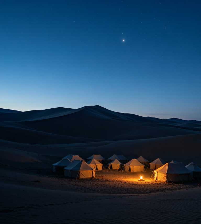
Sleeping in the Sand: Desert Camps on a Xinjiang Road Trip
From simple tented camps to starlit desert stays, here is how overnighting in Xinjiang’s sand fits a self-drive itinerary.
Luggage Storage in Xinjiang: Travelling Light Between Legs
How to store bags between a flight and a drive, or before a side trip, across Xinjiang’s cities and stations.
Wind Power in Xinjiang: Inside China’s Largest Wind Energy Base
The Dabancheng wind corridor near Urumqi holds some of China’s biggest turbines. Here is what travelers see from the road and how to plan a visit.
Responsible Tourism in Xinjiang: How to Travel in a Way That Respects People and Place
A practical guide to responsible tourism in Xinjiang: support local families, buy direct from makers, and tread lightly at lakes and pastures.
Staying Healthy in Xinjiang: Altitude, Stomach, Sun, and the Medical Realities Nobody Warns You About
Xinjiang travel health: Pamir altitude sickness, food-borne stomach troubles, desert sun and dry air, plus the insurance and kit to pack before you go.
Money in Xinjiang: ATMs, Mobile Pay, and How to Bargain in the Bazaars
How money works in Xinjiang: mobile pay, ATMs, foreign cards, and bazaar bargaining tips for independent travelers.