The Taklamakan Desert: Crossing the Sea of Death, Its Oasis Towns, and Silk Road Ghosts
Everyone photographs the lakes. I think the more honest symbol of Xinjiang is the sand. The Taklamakan — from a local word often glossed as “go in and you will not come out” — is the second-largest shifting-sand desert on Earth, bigger than many countries, and it has shaped every trade route, oasis, and border in the south of the region for two thousand years. You do not need to be a desert nut to appreciate it; you just need to understand that the green, liveable Xinjiang exists only because of the dead sea beside it.
How Big, How Harsh
The Taklamakan fills the Tarim Basin, a closed depression in southern Xinjiang ringed by the Tianshan to the north and the Kunlun to the south. It is roughly 1,000 km east to west and up to 400 km wide, with dunes that routinely top 100–300 metres. Rainfall is under 40 mm a year; summer surface temperatures can exceed 70°C. This is why the old Silk Road ran around the edge, not across.
| Fact | Number | Why it matters |
|---|---|---|
| Area | ~337,000 km² | Larger than Italy |
| Dune height | 100–300 m | Towers over a truck |
| Annual rain | < 40 mm | Nothing grows unaided |
| Crossing roads | 2 highways | Built only since 1990s |
| Edge oases | ~10 historic | All Silk Road towns |
The Two Highways That Cross It
Until the 1990s the Taklamakan had no through road. Now it has two, and they are the reason a traveller can stand in the middle of the sand sea and still make dinner in a hotel. Both are engineering monuments; both are surreal to drive.
| Highway | Route | Length | Experience |
|---|---|---|---|
| Taklamakan Desert Highway (S165) | Kuqa → Minfeng | ~520 km | Dead-straight, ribbon of road, nothing else |
| Hotan–Aksu Highway | Aksu → Hotan | ~420 km | Newer, similar emptiness |
Driving the Desert Highway
The Taklamakan Desert Highway is the headline experience: hundreds of kilometres of two-lane road with windbreak reed grids on both sides and a service point every 100 km or so. Fuel up and carry water; breakdown response is slow. It is one of the strangest, most beautiful drives in the country, and the silence at the midpoint — no town, no hill, no sound — is something you remember for years.
The Cities Buried Under the Sand
Part of the desert’s pull is archaeological. The Taklamakan swallowed whole civilisations. Niya, at its western edge, preserved wooden houses, written tablets, and textiles under the dunes for eighteen centuries until explorers found them in the early 1900s. Loulan, near Lop Nur, was a kingdom on a now-vanished lake. These sites are protected and require permits and guides, but the museums in Kuqa and Aksu hold the finds, and standing in front of a 1,800-year-old woven rug makes the “Sea of Death” feel less empty and more abandoned. The desert did not just block the Silk Road; it archived it.
Plants and animals that beat the heat
The basin is not lifeless. Tamarisk and saxaul shrubs stabilise the dune fringes, and the Tarim river supports the world’s most northerly populus euphratica (desert poplar) forest, which turns gold in October. Bactrian camels, goitered gazelles, and rare migratory birds use the river corridors. You will not see much from the highway, but the poplar groves near Yarkand and the Hotan river are worth a detour in autumn.
Oasis Towns on the Edge
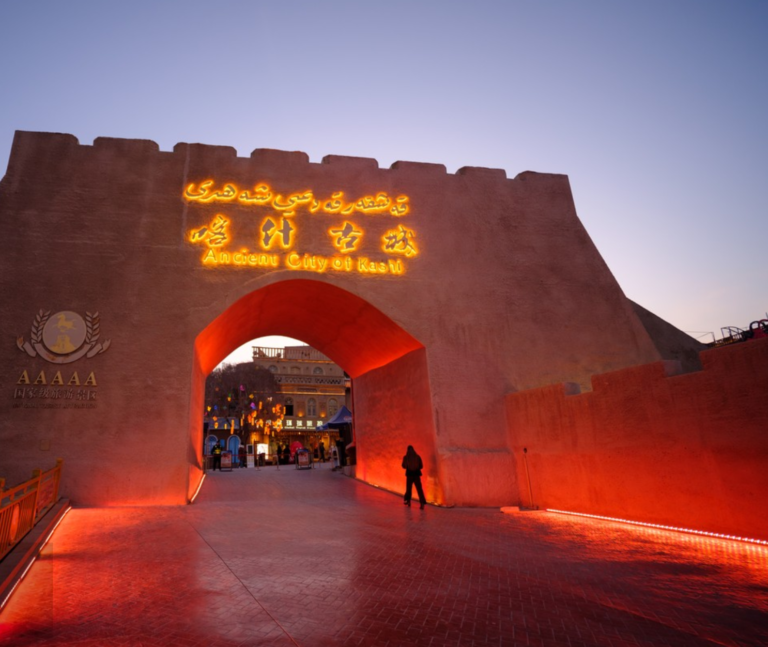
The desert is not empty of life — its rim is a necklace of oasis cities, each a former Silk Road stop. Approaching from the south or west, the standouts are Kashgar in the west, Khotan (Hetian) to the south, Aksu to the north, and Kuqa to the northeast. Each sits where a river leaks out of the mountains and dies in the sand, and each has a distinct flavour — Kashgar is the Silk Road bazaar city, Khotan the jade and carpet town, Kuqa the Buddhist-cave and Qiuci heritage spot.
Kucha and the buried cities
East of the highway’s north end, the ruins of Niya and Loulan sit under the sand — accessible only on special permits and expeditions. Most travellers content themselves with the museums in Kuqa and Aksu, which hold the wooden tablets and textiles pulled from the dunes, and with a day drive to the poplar forests.
How to See the Taklamakan Without Getting Lost
You do not need to cross it to feel it. The easiest, safest desert experiences are: drive one segment of the Desert Highway from Kuqa or Aksu; watch the sunset dunes from the edge oasis of Yarkand or Hotan; or take the train, which now skirts the basin on both sides. If you want the full crossing, go with a driver who has done it, in a fuelled 4×4, in spring or autumn — never mid-summer.
When to go and what to pack
Spring (April–May) and autumn (September–October) are the only sensible windows; summer is dangerously hot, winter brutally cold with ice on the road. Pack 5 litres of water per person per day, a shade layer, a real map (signal dies), and tell someone your plan. The desert does not forgive complacency, and the nearest help can be two hours away on a straight road that looks identical in every direction.
Photographing the Taklamakan
The dunes are seductive to shoot and unforgiving to gear. Blowing sand will find any open zipper, so bring a simple cover for the lens and never change glass in the wind. The light is best in the first hour after sunrise and the last hour before sunset, when the ripples throw long shadows and the sand turns orange rather than white; midday flattens everything. A polariser helps cut glare off the bright slopes. Resist stomping a “path” into a pristine dune for a hero shot — the wind will erase your footprints by morning, but the plants you crush will not recover. The best frames are the ones you wait for: a single camel train, a distant pylon, or the highway disappearing into nothing.
If it goes wrong, this is what to do
If this happens: Actually drive across the taklamakan
Yes, on the two paved highways. They are maintained and serviced, but remote. Do not attempt them on a near-empty tank or in a worn tyre.
When it goes sideways: Dangerous to visit
The edge oases and the highways are safe and routine. The danger is only if you leave the road unprepared. Treat the desert as a mountain: respect the distances.
If you run into this: Called the “sea of death
Because the shifting dunes, lethal heat, and lack of water killed countless Silk Road travellers and buried several oasis cities. The name is a warning, not a legend.
On the ground: Oasis town is the best base
Kashgar, hands down — it has the airport, the bazaar, and the best link roads north to the highway. Khotan is the southern alternative if you are continuing toward the Pamirs.
If this happens: There trains through the desert
The railways run around the basin, not across it, but you can ride the northern or southern ring and watch the dunes from the window. It is the low-effort way to “see” the Taklamakan.
When it goes sideways: Camping in the dunes
Technically yes, with a guide and permits for protected sections; practically, most travellers camp at organised sites near the highway service points. Wild camping alone is not advised.