Taklamakan Desert Highway: Crossing the Sea of Death by 4×4
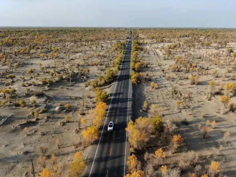
Crossing the Taklamakan Desert (塔克拉玛干) — known as the “Sea of Death” — on the Desert Highway (沙漠公路) is one of the great road-trip challenges left on Earth. At ~337,000 km², it’s the world’s second-largest shifting-sand desert. The highway itself — specifically the G216 Lunai → Minfeng or the G217 spur Kuqa → Hotan — gives you ~450 km of straight asphalt between nothing and nothing, telephone poles marching like soldiers, and the occasional sandstorm turning the sky the color of raw umber.
This isn’t about dunes every minute. It’s about scale. You’re crossing a landscape that broke the Silk Road into a northern and southern route because no one could cross the middle. Now you can — in a 4×4 SUV with 3L of water and a full fuel tank.
Route Options: Which Desert Highway to Take
| Route | Distance | Character | Best For |
|---|---|---|---|
| G216: Lunai → Minfeng | ~450 km | Classic north–south traverse; the most famous desert highway crossing | First-time desert crossers who want the full “Sea of Death” experience |
| G217 spur: Kuqa → Hotan | ~420 km | Similar drama, slightly different access; passes near the Tianshan foothills | Travelers already in the Kuqa area who want to connect to Hotan |
| Partial traverse (day trip) | 100–200 km | Enter from Lunai, drive 2–3 hours into the desert, turn back | Travelers short on time who still want the desert highway experience |
Pro tip: The G216 Lunai–Minfeng route is the most iconic. It’s also the one with the best support infrastructure (Tazhong gas station at ~km 220). If this is your first desert crossing, start here.
When to Cross the Taklamakan (And When NOT)
| Season | Temperature Range | Road Conditions | Verdict |
|---|---|---|---|
| October–April | Day: 10–25°C / Night: –5 to 5°C | Excellent; no overheating risk | ⭐⭐⭐⭐⭐ Best time |
| May & September | Day: 25–35°C / Night: 5–15°C | Doable with proper preparation | ⭐⭐⭐⭐☆ Good |
| June–August (midday) | Day: 40–50°C / Night: 20–30°C | Brutal; asphalt can soften; heat exhaustion risk | ⭐⭐☆☆☆ Only in climate-controlled transport |
| Winter (Dec–Feb) | Day: –10 to 10°C / Night: –20°C | Dramatic but fuel gelling risk; road salt | ⭐⭐⭐☆☆ For experienced winter drivers only |
Golden rule: If you’re attempting the full crossing in summer, start driving by 05:00 and be off the highway by 13:00. The afternoon heat in July can hit 50°C — hot enough to cook an egg on the hood.
Vehicle & Logistics: What You Actually Need
Vehicle Requirement
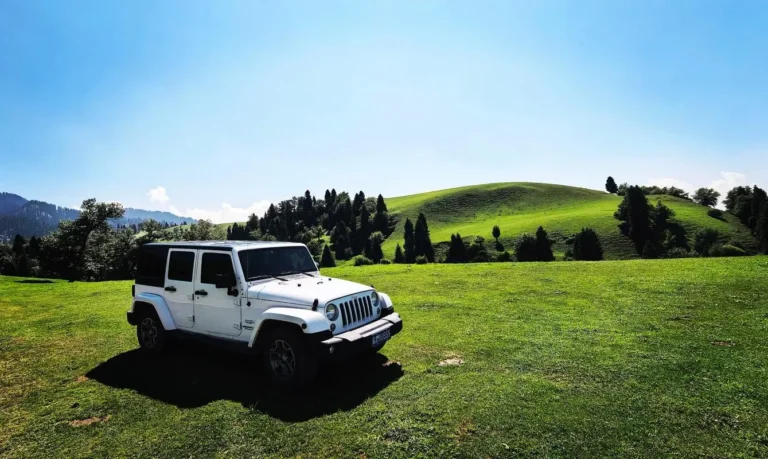
- 4×4 SUV mandatory if you plan any dune detours or leave the main asphalt. The highway itself is paved, but if a tire blows or sand drifts cover the shoulder, you need clearance and recovery boards.
- Spare tire + repair kit: The desert highway has sharp gravel shoulders. A puncture out here means a long wait for roadside assistance (if it even comes).
- Dual fuel tanks or jerry cans: The only reliable fuel stop between Lunai and Minfeng is Tazhong (塔中) at ~km 220. Fill up at both ends AND at Tazhong.
- Satellite communicator (Garmin inReach, Spot): Mobile coverage is spotty. A satellite messenger lets you call for help if you’re stranded.
Fuel Strategy
Fill up at Lunai (north end) → drive ~220 km → fill up at Tazhong (the surreal oilfield/oasis outpost) → drive ~230 km → fill up at Minfeng (south end). Never attempt the full crossing on a single tank — even with a 4×4’s large tank, the soft asphalt and headwinds increase fuel consumption.
Water & Food
- Water: 3L/person minimum. The desert is bone-dry; you’ll drink more than you think.
- Food: Pack 2 days of non-perishable food (nuts, energy bars, tinned fish). Tazhong has basic noodles and a dormitory, but don’t rely on it for a full meal.
- Shade: There is none. If you break down, you’re in full sun. A reflective sunshade for the windshield and a pop-up tent are worth their weight in gold.
Safety Precautions (Non-Negotiable)
The Taklamakan isn’t a place to test your luck. These precautions aren’t suggestions:
- Tell someone your itinerary: Share your start time, route, and expected arrival time with a hotel or agency. If you don’t arrive within 3 hours of your ETA, they should call for help.
- Check weather before departure: Sandstorms can reduce visibility to zero in minutes. If a storm is forecast, postpone. The desert highways have emergency pull-offs, but you don’t want to be stuck in a whiteout (sandout?).
- Don’t drive alone: A convoy of 2+ vehicles is ideal. If one breaks down, the other can shuttle for help.
- Acclimatize to the heat: Even in October, the desert is dehydrating. Start drinking water 24 hours before your crossing.
- No off-roading without a local guide: The desert looks flat but has soft sand pockets that will swallow a 4×4 up to its doors. Stick to the asphalt unless you have a local guide who knows the terrain.
What to Pack for the Desert Highway
| Item | Why You Need It | Priority |
|---|---|---|
| 3L water per person (minimum) | Dehydration happens fast in 10% humidity | ⭐⭐⭐⭐⭐ |
| Wide-brim hat + SPF 50+ sunscreen | The sun at midday is merciless; UV reflects off sand | ⭐⭐⭐⭐⭐ |
| Lightweight long sleeves/pants | Protects from sun + sand; desert sunburn happens through car windows | |
| Satellite communicator | No mobile coverage for ~200 km of the crossing | ⭐⭐⭐⭐⭐ |
| Spare tire + repair kit + compressor | A puncture out here is a serious situation | ⭐⭐⭐⭐⭐ |
| Reflective sunshade + pop-up tent | If you break down, you need shade while waiting for help | ⭐⭐⭐⭐☆ |
| Power bank (2x) | Cold at night drains batteries; no charging on the highway | ⭐⭐⭐☆☆ |
The Experience: What You’ll Actually See
First 50 km: The Edge of the World
Leaving Lunai, the highway cuts through a transition zone of scrub and low desert bushes. You’ll see local herders moving sheep, the occasional donkey cart, and the last stands of Populus diversifolia (desert poplar) before the real desert takes over. This is where you take your “entering the Sea of Death” photo.
Km 100–350: The Big Nothing
This is the heart of the crossing. No towns, no services, no turn-offs. Just asphalt, telephone poles, and the occasional maintenance truck. The silence at a pull-off is absolute — no birds, no wind (usually), no human sound. It’s one of the few places left on Earth where you can stand and see nothing man-made in any direction.
Photography note: The straight-road perspective shot is classic here. Use a polarizer to cut glare on the asphalt. The best light is within 1 hour of sunrise or sunset; midday washes everything flat.
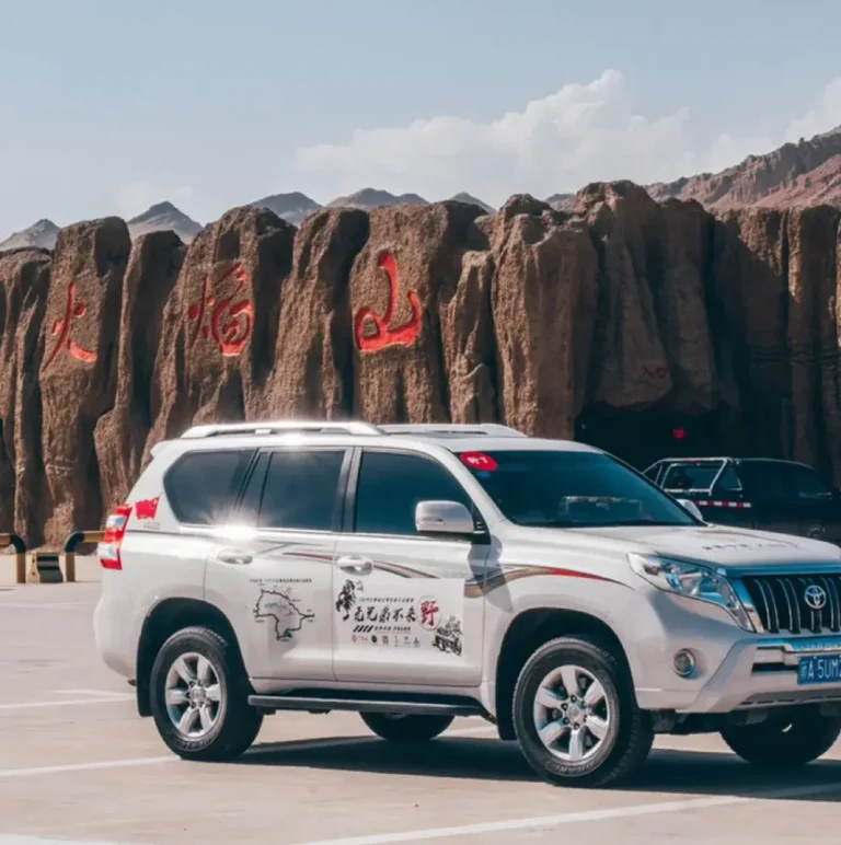
Tazhong (km 220): The Surreal Oasis
Tazhong (塔中) is a surreal oilfield outpost in the middle of nowhere. It has a gas station (fill up here — don’t skip), basic noodles, and a dormitory for oil workers. You can’t miss it — it’s the only thing for 200 km in either direction. Stop for a bathroom break, take a photo of the “oasis in the desert” sign, and buy a cold drink if the station has power.
Final 100 km: Approaching Minfeng
As you near Minfeng (民丰), the desert scrub returns, then farmland, then the fringe of the town. The contrast is striking — from absolute nothing to irrigation canals and poplar trees in the space of 20 km. Check into your hotel, take a long shower, and celebrate surviving the Sea of Death.
Leave No Trace: Desert Ecology is Fragile
The Taklamakan looks indestructible — it’s a desert, after all. But the desert ecosystem is hyper-fragile. The scrub brush that looks like “nothing” is actually a carefully balanced community that stabilizes the sand. Driving over it once can create a track that takes decades to heal.
- Stay on the asphalt. Don’t drive on living scrub, no matter how firm it looks.
- Pack out everything. There’s no waste collection on the highway. If you brought it in, carry it out.
- Don’t collect “cool rocks” or sand samples. Everyone thinks they’re the only one; collectively, it adds up.
Sample Itinerary: The Classic Lunai → Minfeng Crossing
| Day | Morning (05:00–12:00) | Afternoon (12:00–18:00) | Evening |
|---|---|---|---|
| Day 1 | Depart Lunai by 05:00. First light on the desert ~06:30. Stop at km 50 for photos. | Continue south. Stop at Tazhong (km 220) for fuel + noodles (13:00–14:00). | Push through the southern half. Arrive Minfeng by 17:00. Check into hotel, dinner. |
| Day 2 (optional) | Rest day in Minfeng. Explore the town, visit the local market. | Drive Minfeng → Hotan (~280 km, 4 hrs). Hotan old town, jade market. | Stay in Hotan. Celebrate with a proper Uyghur feast. |
Time your crossing for October if you can. The temperatures are perfect (20–25°C days, 5–10°C nights), the light is incredible, and you’ll have the highway largely to yourself (except for the occasional oil truck).
Combining the Desert Highway with Other Xinjiang Routes
- From Kuqa (north): Drive south on G217 to connect to the Desert Highway. This gives you canyon country (Tianshan Grand Canyon) followed by the desert — a dramatic landscape transition in 6 hours.
- To Hotan (south): After crossing, spend 2–3 days in Hotan — the jade capital of Xinjiang, with an atmospheric old town and the famous Hotan Sunday Market.
- Loop via the southern Silk Road: From Hotan, drive east to Yarkand (Shache) and eventually back to Kashgar. This completes a full southern Xinjiang loop that includes the desert, the oasis towns, and the Pamir foothills.
Final Thoughts
Crossing the Taklamakan Desert Highway isn’t the safest or most comfortable thing you’ll do in Xinjiang. It’s also the thing you’ll talk about for the rest of your life. There’s a reason the Silk Road split into northern and southern branches — no one wanted to cross the middle. Now you can, in a modern SUV with GPS and satellite comms. But the scale and silence of the place? Those haven’t changed since Zhang Qian rode through 2,000 years ago. Pack water, start early, and prepare to feel very small in a very big landscape.
Planning a Xinjiang self-drive route? Our Karakoram Highway guide covers the other epic Xinjiang road trip, and our complete travel guide has tips for every region.