Qiongkushitai: Xinjiang’s Off-Grid Kazakh Village and Cedar Trailhead
Figures for distance, fees, and transfer costs change from season to season, so treat every number here as a planning estimate and reconfirm with a licensed operator or your accommodation before you travel.
Overview and key facts
Qiongkushitai (琼库什台) is a Kazakh herding village in Tekes County, in the Ili region of northwestern Xinjiang. The name is often translated loosely as a place of broad, flat river terraces. The village sits at roughly 1,900 to 2,000 meters above sea level, tucked into a river valley beneath the same spruce covered ridges that define the wider Tianshan Mountains.
A UNESCO component, not a ticketed park
According to materials from the Xinjiang Tianshan UNESCO World Heritage property, the forested slopes around Qiongkushitai are part of the broader Tianshan cedar ecosystem, locally known as 雪岭云杉 (snow ridge spruce). Unlike the heavily developed grassland resorts nearby, Qiongkushitai remains a working village. Families still move livestock to summer pasture, and the timber framed houses and winter shelters follow traditional Kazakh building methods.
Off-grid and low signal
Official sources and traveler reports agree on one practical point: Qiongkushitai is largely off-grid. Mobile signal is weak or absent across much of the valley, bank cards and scanning apps are unreliable, and the last stretch of road is unpaved. This is the appeal for many visitors, and also the reason advance planning matters.
Getting there
The standard route runs from Yining, the main city of Ili, to Tekes town, then east and south into the mountains toward the village. Yining to Tekes is a paved highway of roughly 115 kilometers and takes about two hours by car. From Tekes town to Qiongkushitai is about 90 kilometers, but only the first part is sealed road. The final 30 to 40 kilometers follow a mountain track that is rough, narrow in places, and prone to washouts after rain.
How visitors actually reach the village
Most travelers book a licensed agency transfer from Tekes or join a small group tour. A regular sedan can sometimes manage the track in dry summer conditions, but operators and recent traveler reports consistently recommend a high clearance 4×4, especially after rain or early in the season when the road is still soft. Self driving is possible, but the self drive caveat is clear: there is no fuel, no repair shop, and no signal in the valley, so a breakdown means a long wait. Many drivers therefore arrange the final leg through a local operator rather than risk the mountain track alone.
Tickets and costs
The village itself is free to enter. There is no gate or admission charge to walk among the houses and pastures. What costs money is access: travelers report a local ecological management or road maintenance fee at the village checkpoint, plus the cost of getting there. Agency transfers quoted from Tekes ran around 300 to 500 RMB per vehicle as of 2024 and 2025, with prices rising for private 4×4 hire and for the peak months of July and August. These are planning figures only and should be reconfirmed.
What you actually pay for
| Cost item | Typical range (2024 to 2025) | Notes |
|---|---|---|
| Village entry | Free | No ticket gate |
| Road or ecological management fee | Approx. 30 to 80 RMB per person | Reported at the village checkpoint, reconfirm |
| Shared agency transfer from Tekes | Approx. 300 to 500 RMB per vehicle | Usually 4×4, round trip or one way |
| Private charter from Yining | Higher, varies by operator | Book ahead in peak season |
| Homestay bed | Approx. 150 to 400 RMB per night | Wooden cabin, meals often extra |
Best time to visit
The useful window is June through September. June and July bring the greenest pastures and full river flow, with wildflowers across the terraces. August stays warm and busy. September is the favorite of many photographers: the spruce stays dark green while the aspens and meadows turn gold, and the crowds thin after the school holidays.
Travelers report that the valley becomes hard to reach once snow arrives, typically from late October or November, and the access road can be closed by winter conditions until the following late spring. For wider regional timing, see our guide to the best time to visit Xinjiang.
Day-by-day itinerary
A single night barely scratches the surface, so the plan below is a two day, one night outline that most operators and returning travelers recommend. Times are suggestions, not fixed schedules, since weather and road conditions set the real pace.
Day 1, Tekes to Qiongkushitai and the cedar trail
| Time | Activity | Notes |
|---|---|---|
| 08:30 | Depart Tekes town by 4×4 transfer | Stock water and cash first |
| 10:30 | Stop at the mountain pass viewpoint | First sight of the spruce valley |
| 11:30 | Arrive village, check in to homestay | Confirm dinner and breakfast |
| 13:00 | Lunch at the homestay | Kazakh dairy and noodles |
| 14:30 | Hike the cedar (雪岭云杉) trail above the village | 3 to 5 km, gain is moderate |
| 18:00 | Return, photograph the timber houses at low light | Charge devices now |
| 19:30 | Dinner and early rest | No signal, enjoy the quiet |
Day 2, river valley and return
| Time | Activity | Notes |
|---|---|---|
| 08:00 | Breakfast, walk the river terraces | Watch the herd move out |
| 09:30 | Short valley walk toward the threading river | Easy, family friendly |
| 11:30 | Pack and settle the homestay bill in cash | Card may not work |
| 12:30 | Depart for Tekes | Allow buffer for the track |
| 14:30 | Reach Tekes, onward to Yining or Tekes | Refuel and reconnect |
Where to stay
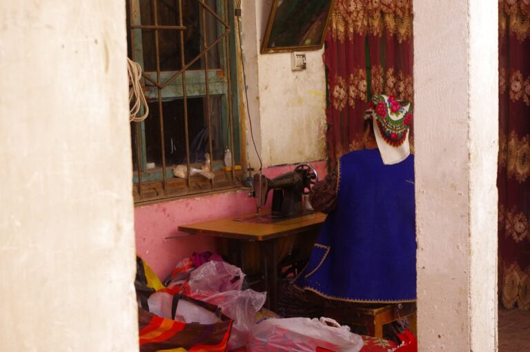
Accommodation in the village is mostly family run homestays in wooden cabins, the same timber style used by local herders. Travelers report simple but warm rooms, shared bathrooms in many cases, and hearty home cooked meals booked with the family. Spaces are limited and there is no online booking system that works reliably without signal, so arrange through your transfer operator or by phone before you leave Tekes.
Fallback base in Yining
If the road is closed, or you prefer hotels and reliable internet, use Yining as your fallback base and visit as a long day trip with a driver. You lose the quiet of the village night, but you keep flexibility. The Sayram Lake area and other Ili sites can be combined on a wider loop from there.
Food, what and where to eat nearby
Meals in Qiongkushitai are Kazakh home cooking. Expect fresh milk tea, thick yogurt, cream, and fermented mare’s milk (kumis) in season, alongside boiled or roasted lamb, hand pulled noodles, and flat naan baked over open fire. Most visitors eat all meals at their homestay, because there is no restaurant strip and supplies are limited.
The dairy and lamb reflect the wider Xinjiang food guide, but here the versions are rustic and direct from the herd. Tell your host in advance if you are vegetarian, since the table is meat heavy and vegetables are scarce at altitude. Carry snacks and cash, because shops in the valley are few and card payment is uncertain.
Practical tips
Signal, maps, and money
Assume no mobile data in the valley. Download offline maps for Tekes and the village before you leave the city, and tell someone your plan. Bring enough cash for the road fee, transfer, homestay, and meals, because scanners and ATMs are not dependable here.
Clothing and road sense
Even in July the nights are cold at 1,900 meters, so pack warm layers, a rain shell, and sturdy shoes for the cedar trail. Respect herding life: do not block the livestock paths, ask before photographing people, and keep gates as you found them. The mountain track is weather dependent, so build a buffer into every plan and never rush the descent.
A few things worth answering
Is Qiongkushitai village free to enter?
Yes. There is no ticket gate for the village itself. Travelers report a separate local ecological management or road fee at the checkpoint, but walking the village and pastures is free.
How far is the village from Tekes and Yining?
About 90 kilometers from Tekes town, and roughly 200 kilometers from Yining when you add the Tekes highway leg. The drive from Tekes takes around two to three hours because the final stretch is a slow mountain track.
Do I need a 4×4, or can a normal car reach it?
A sedan may pass in dry high summer, but licensed operators and recent reports recommend a high clearance 4×4 for the unpaved final section. After rain the track gets slippery and risky for low cars.
Is there phone signal or internet in the village?
Very weak or none across most of the valley. Download offline maps, arrange everything by phone before you leave Tekes, and expect to be disconnected until you return to town.
Can I visit in winter?
Generally no. Snow typically closes the access road from late autumn, and the village is hard to reach until the following late spring. Plan a June to September trip for reliable access.
How many days should I spend there?
Two days and one night is the common recommendation, enough for the cedar trail and a valley walk without rushing. A single day trip from Yining is possible but tiring given the track.
Are there restaurants, or do I eat at the homestay?
You eat at the homestay. There is no restaurant district, and supplies are limited, so book meals with your host when you arrange the room.
Is Qiongkushitai part of the Kuerdening scenic area?
They share the same Tianshan spruce ecosystem and lie in the same county, but Qiongkushitai is a separate village with its own access road rather than a ticketed section of the Kuerdening reserve. The comparison below shows how the three Ili sites differ.
| Site | Crowds | Road access | Signal | Style |
|---|---|---|---|---|
| Qiongkushitai | Low | Unpaved 4×4 track | None or weak | Working Kazakh village, free entry |
| Nalati Grassland | High in peak season | Paved, bus tour ready | Good | Developed scenic park with ticket |
| Kuerdening | Moderate | Paved to gate, then trails | Partial | Reserve with managed entry |

The spruce cover of the Ili valleys, shown here in the Kuerdening area, is the same forest system that wraps Qiongkushitai. The dark, straight cedars are 雪岭云杉, the snow ridge spruce that defines the Tianshan foothills.

For contrast, the Nalati area pairs open alpine meadow with woodland and carries far heavier visitor numbers. Qiongkushitai offers a quieter, village based version of the same mountain scenery.

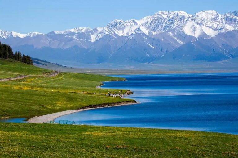
Many travelers pair Qiongkushitai with other Ili highlights such as Sayram Lake, using Yining as the connected base for a wider northern Xinjiang loop.