Guozigou Bridge: The Cable-Stayed Span Over an Alpine Gorge
East of Yining, the G30 highway crosses the Guozigou (果子沟) gorge on a cable-stayed bridge that looks engineered for a postcard — a slender span arcing over a deep pine valley, with snow peaks behind it. At ~200 m above the gorge floor, it’s one of the highest bridges in China, and the designated viewpoint on the east side is one of the most-photographed road frames in Xinjiang. Most travelers cross it without stopping; the ones who pull over get the shot.
Last updated: July 15, 2026 · Written by Karl Huang, a Xinjiang travel specialist who has spent time across the region. Practical details are cross-checked against official tourism, transport, and border-regulation sources.
It’s the gateway between the Ili Valley and the north, which is why it’s on every Ili loop.
The Gorge
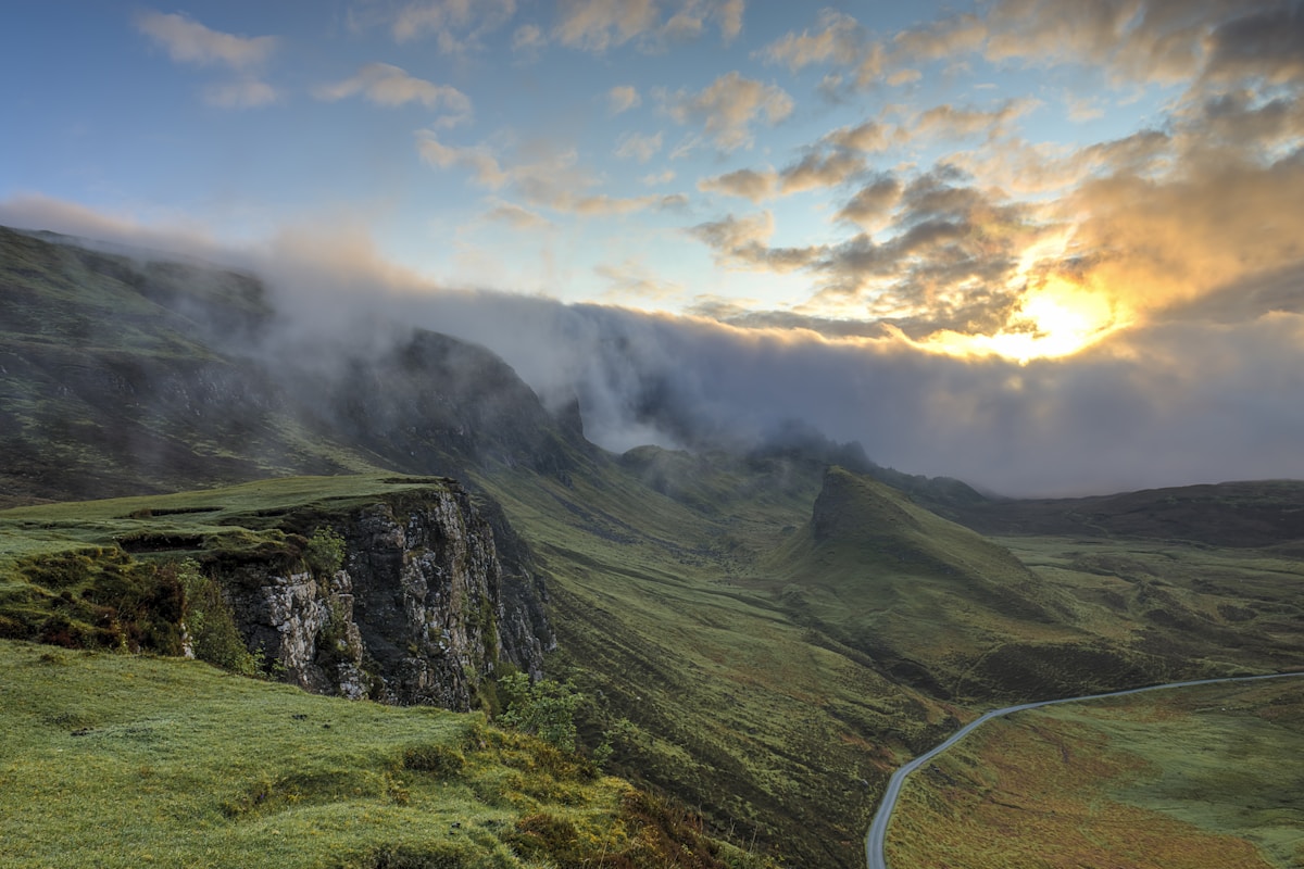
Guozigou is a narrow, lush cleft in the Tianshan — pine forest, a rushing river, and frequent mist that wraps the bridge in cloud. The road switchbacks down through it on both sides; the bridge is the midpoint. In summer it’s green and cool; in autumn the surrounding hills turn and the contrast with the blue gorge is striking. The viewpoint overlooks the whole span from the east.
Where to Stop
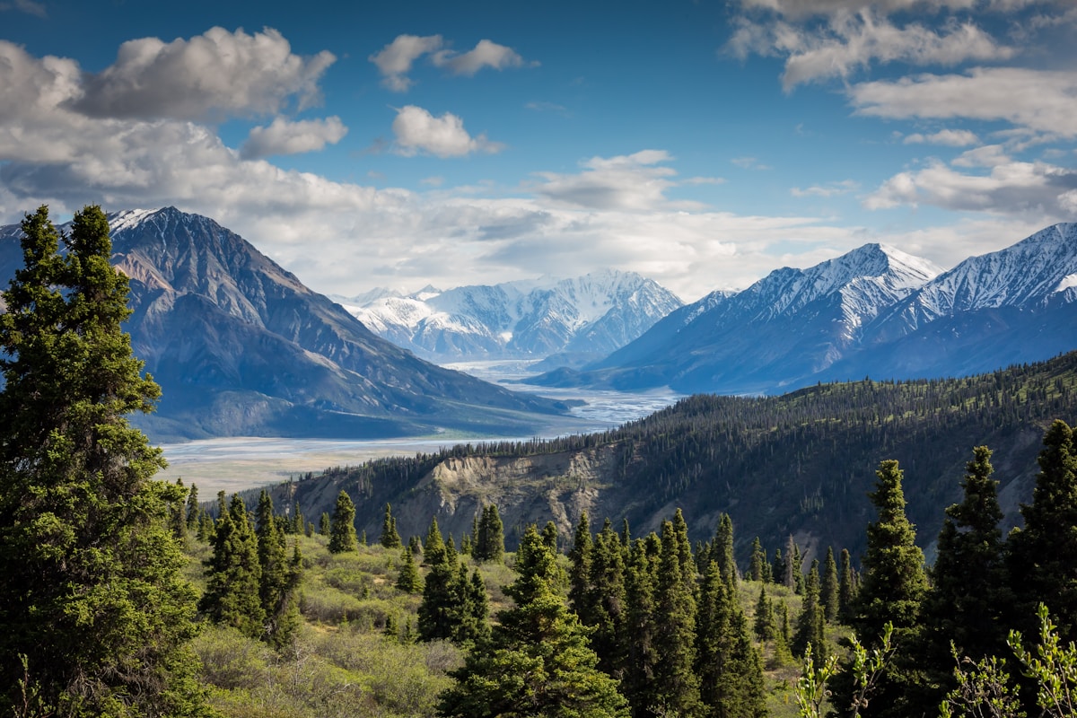
The highway has a signed viewing area on the east approach — pull in, walk to the rail, and shoot back west at the bridge with the gorge below. Morning light hits the bridge face; afternoon lights the far peaks. Drones are restricted near the highway, so ground shots are the play. Combine the stop with the nearby Sayram approach for a full morning of gorge-and-lake views.
How It Fits
Guozigou is the natural break between Urumqi/Yining and Sayram Lake — you cross it either way. Time it as a deliberate stop, not a pass-through: 20 minutes at the viewpoint turns a transit point into a highlight. It’s also a weather bellwether — if the gorge is clear, Sayram will be too; if it’s fogged in, expect the same at the lake. For a Xinjiang Travel Guide northern loop, the bridge is the moment the valley opens to the alpine.
Why It’s Worth the Stop
Bridges are usually infrastructure; this one is scenery. The combination of engineering and alpine gorge is rare, and the viewpoint makes it easy. Pull over, take the frame, and you’ve captured one of the region’s most modern icons against its oldest mountains.
The Gorge and the Viewpoint
Guozigou is a narrow, lush cleft in the Tianshan – pine forest, a rushing river, and frequent mist that wraps the bridge in cloud. The road switchbacks down through it on both sides, with the cable-stayed span as the midpoint. The highway has a signed viewing area on the east approach: pull in, walk to the rail, and shoot back west at the bridge with the gorge below. Morning light hits the bridge face; afternoon lights the far peaks.
What goes in the day pack
Sunscreen and a brim. A wind shell. The light here is serious and the shade is intermittent, so the sunscreen goes on before you leave the hotel, not at the gate. The temperature drops fast once you stop moving and the drop is not hypothetical on an exposed pass.
A fleece covers most of the year, a real jacket covers shoulder season. Water, more than you think, a power bank and some cash. Cards work at the gate and in the shops, but the stalls on the approach road and the drivers waiting at the turnoff want cash, and coming up short at the moment you want a lift is the classic way to lose an hour. Where most people get the logistics wrong is covered in our [[the-sayram-lake-loop-self-driving-the-alpine-ring-road-and-guozigou-bridge|The Sayram Lake Loop: Self-Driving the…]].
Who should think twice about {P}
It suits people who like landscape and can walk a few kilometres at their own pace. If you are short on days, this is the thing to cut, and no guidebook will tell you that. Guozigou Bridge The Cable is superb, but it is also an hour or more in each direction from everything else you planned, and the drives are what eat the schedule. It suits a traveller with a car and a flexible morning. It does not suit a family with a small child who needs a shade stop every forty minutes, and it does not suit anyone in week two of a high-altitude trip still feeling it.
The honest version: take half a day if that is all the arithmetic allows, and save the full day for the thing that is genuinely once in a lifetime. I am not going to pretend this is gentle. There is a lot of unshaded ground, the altitude is real if you came from a low-altitude city, and the swing between the car and the viewpoints is enough to give you a headache on an empty stomach. Who it does suit: someone wanting one strong memory, someone driving the Xinjiang loop anyway, someone willing to be out before breakfast.
Who it does not: anyone whose main goal is a relaxed few days, and anyone who has already done this same thing twice here.
Timing and Constraints
Drones are restricted near the highway, so ground shots are the play. Combine the stop with the nearby Sayram Lake approach for a full morning of gorge-and-lake views. In summer the gorge is green and cool; in autumn the surrounding hills turn and the contrast with the blue gorge is striking. If the gorge is clear, Sayram will be too – the bridge is a reliable weather bellwether for the lake.
How It Fits the Northern Loop
Guozigou is the natural break between Urumqi or Yining and Sayram Lake – you cross it either way. Time it as a deliberate stop, not a pass-through: twenty minutes at the viewpoint turns a transit point into a highlight. For a northern Xinjiang road trip, the bridge is the moment the valley opens to the alpine, and the Tianshan Mountains rise behind it as you climb toward the lake.