
Tianshan Grand Canyon (Urumqi): Hiking Routes and What to Expect
The Tianshan Grand Canyon (天山天山大峡谷), southeast of Urumqi, is the capital’s nearest real mountain escape — red rock, glacier-fed streams, and Kazakh yurt pastures. This is the hiking-routes angle; for the city overview see the Urumqi guide.
The layout
The scenic area is a valley system: a road runs in, with trailheads branching to lakes, meadows, and viewpoints. Most visitors ride the shuttle to the main stops and walk from there.
Route 1 — The lakeside meadow walk (easy)
From the main shuttle stop, a flat-ish trail follows the stream to an alpine lake backed by red cliffs. Family-friendly, 1–2 hours return. Best in morning light when the rock glows.
Route 2 — The ridge and viewpoint (moderate)
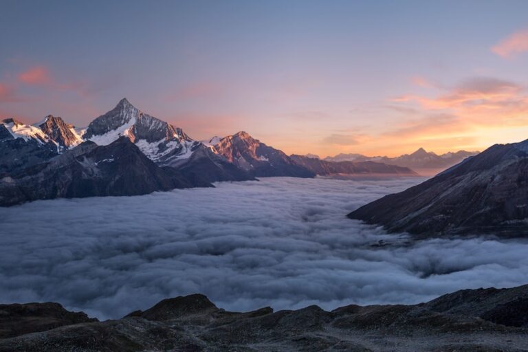
A steeper climb above the meadow gives you the classic “red canyon + snow peak” panorama. Allow 2–3 hours; the altitude (the valley floor is already ~2,000 m) makes the climb slower than it looks.
Route 3 — The glacier-stream trek (strenuous)
For fit hikers, a longer trail follows the meltwater toward the high cirque. Not technical, but remote-feeling and weather-exposed — go with a partner and start early.
What to expect
- Season: best May–October; the high trails can hold snow into early summer.
- Altitude: take it slow; the thin air is the main challenge, not the terrain.
- Facilities: basic inside; bring water, food, and a layer even in summer.
It pairs well with a self-drive loop around Urumqi if you have a car.
Getting there from Urumqi
The canyon sits southeast of the capital, roughly an hour’s drive out — close enough for a half-day trip if you have a car. Without one, it’s a taxi or a joined day tour; the public option is thin, so most visitors combine it with a self-drive loop around Urumqi rather than treating it as a standalone errand.
Tickets and best time
- Season: May–October is the window; the high trails can hold snow into early summer, and winter closes the upper routes.
- Shuttle: a scenic-area bus runs from the gate to the main stops — most people ride it and walk from there rather than driving the valley themselves.
- Altitude: the valley floor is already around 2,000 m; the thin air, not the terrain, is the main challenge, so pace the climbs.
What goes in the day pack
A fleece covers most of the year, a real jacket covers shoulder season. Water, more than you think, a power bank and some cash. Cards work at the gate and in the shops, but the stalls on the approach road and the drivers waiting at the turnoff want cash, and coming up short at the moment you want a lift is the classic way to lose an hour. Sunscreen and a brim. The light here is serious and the shade is intermittent, so the sunscreen goes on before you leave the hotel, not at the gate. A wind shell. The temperature drops fast once you stop moving and the drop is not hypothetical on an exposed pass.
The mistake I made the first time
That is the number of hours the visit needs. I assumed two hours would be plenty. It was, in the sense that I saw everything, and it was ruined in the sense that I saw everything at the same hour with the same crowd, and I spent the drive home meaning to come back and never did. The whole point of coming this far is to have the place to yourself for a while, and that only happens if you are willing to be there when it opens or when it is nearly shut. I did come back the following trip, at seven in the morning, and it was a different site.
What I would tell the version of me who planned it: put the slow hours in, not the fast ones. The other mistake is about distance on the map. The gate is not the site. There is a shuttle, a walk, sometimes another shuttle, and the stretch everybody underestimates is between the second gate and the thing you crossed the country to see. So: work out how far it is from where the vehicle drops you to the feature, then double it.
The short version, with the numbers, is in our [[tianshan-grand-canyon-urumqi-hiking-the-red-rock-formations|Tianshan Grand Canyon (Urumqi): Hiking the…]].
A half-day plan
Arrive mid-morning: ride the shuttle to the lakeside meadow (easy walk, good light on the red rock), then take the ridge viewpoint for the classic “red canyon + snow peak” panorama. Bring water, a layer, and food — facilities inside are basic even in summer. If you have a car, the canyon pairs naturally with a wider Urumqi day-loop; without one, treat it as the morning and head back to the city for the afternoon.
Pair it and pack for altitude
The canyon combines well with Sayram Lake or a Urumqi city half-day if you’re basing in the capital. Bring a windproof layer even in summer — the valley sits high and the wind cuts — plus water and a snack, since food inside the scenic area is limited. Mornings give the best light on the red rock before the sun climbs and flattens the color.