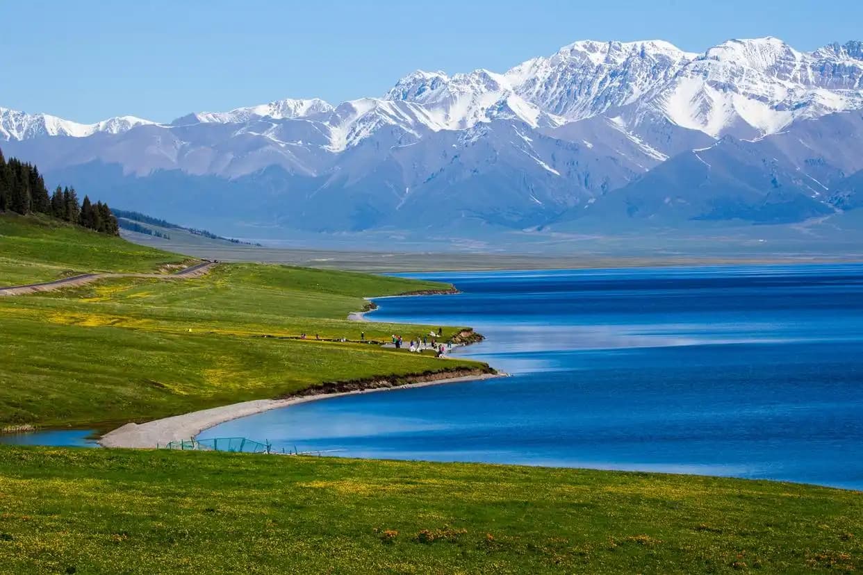
Cycling in Xinjiang: A Research-Based Guide to Road Bike Touring and Long-Distance Routes
Cycling in Xinjiang attracts touring riders who want long, quiet roads, high mountain passes and vast desert basins. It is not drawn from the author’s personal rides. Road surfaces, distances, pass elevations, fuel and water availability, and accommodation conditions change year to year because of construction, weather and seasonal closures. Cyclists report that conditions on remote sections can differ sharply from official maps. Readers should confirm current details with local transport bureaus, recent rider logs and accommodation providers before planning a trip. Where specific figures are given, they reflect the most recent publicly reported values and should be verified locally.
Cycling in Xinjiang: Overview & Key Facts
Xinjiang is China’s largest provincial region, spanning roughly 1.66 million square kilometres. That scale shapes every cycling plan. Distances between supply towns are long, and outside the main corridors services are sparse. Official road data shows the region holds a dense network of national and provincial highways, but many are far from the coast-style density of support services found in eastern China.
Key facts cyclists report planning around:
- Two main basins (Tarim and Junggar) sit between several mountain ranges, including the Tianshan, which split the region into northern and southern halves.
- The Tianshan range creates the famous north-south routes, most notably the Duku Highway, a seasonal mountain road crossing the range.
- Elevations on crossing routes range from around 500 metres in basin towns to over 3,000 metres on high passes, which affects both effort and acclimatisation.
- Wind is a defining factor. Cyclists report strong crosswinds and headwinds on open basin and Gobi stretches, especially in spring.
For a broader context on the region, see our main Xinjiang travel resource.
Reaching it by car
Most cyclists fly or take a train into a gateway city, then assemble and start riding. The main gateways reported by touring cyclists are Urumqi, Yining (for the Ili circuit and Sayram Lake), and Kashgar (for southern routes). Urumqi has the largest airport and rail links and is the usual starting point for northern loops. Yining is the practical gateway for the Ili grasslands and the northern end of the Duku Highway. Kashgar suits riders heading toward the southern Tarim routes.
Flying with a bike: major Chinese carriers allow bicycles as checked baggage when boxed, typically in a hard or soft bike case. Cyclists report that airport bike boxing services and fees vary, so confirm with the airline before departure. Trains: some long-distance services accept boxed bikes as checked luggage, but policies differ by route and season, and space is limited. Many riders ship the bike ahead by rail freight to the gateway city and collect it there. Which gateway to choose depends on the loop you want; the Ili and Duku circuits begin from the north, while Tarim desert loops begin from the south.
Bike, Gear & Costs
The first decision is whether to fly with your own bike or rent locally. Flying with a road or gravel bike gives a known fit and drivetrain, but adds boxing, airline fees and reassembly time. Bike rental inside Xinjiang exists in larger hubs but selection is limited and quality varies, according to cyclist reports. A supported tour removes transport and logistics work but costs more and fixes the schedule.
| Option | Best for | Reported cost range | Main trade-off |
|---|---|---|---|
| Road bike, fly-with own | Paved highway touring, fitness riders | Airline bike fee often 0-200 RMB domestic; bike boxing at airports ~150-300 RMB as of 2025; confirm locally | Carry, box, reassemble, and return logistics |
| Gravel / touring bike, fly-with | Mixed surfaces, remote sections | Similar transport cost; wider tyres add packing size | Heavier, slower on pure tarmac |
| Local rental | Short loops near hubs | Varies widely; verify condition before paying | Limited sizes and component quality |
| Supported tour | First-time visitors, groups | Highest; covers vehicle, guide, meals | Fixed route and pace |
Beyond the bike, cyclists report carrying spare tubes, a chain tool, a multi-tool, sun protection, a windproof layer, and at least two litres of water capacity per person on open stretches. Battery banks and an offline map device are standard because signal drops outside towns.
Best Time to Cycle
The riding season is narrow because of winter cold and summer heat. Cyclists report that the most reliable window is roughly June through September, when mountain passes are clear of snow and basin temperatures are manageable. The best time to visit Xinjiang guide covers the regional pattern in more detail. Spring brings strong winds and occasional sand, while high summer can push basin daytime temperatures above 35 degrees Celsius. The Duku Highway typically opens only after snow clears, often late May or June, and closes again with early snow, so seasonal timing matters for mountain crossings.
The itinerary I would follow
The sample below is a research-based 7-day northern loop centred on Yining, Sayram Lake and the northern Duku approach. Distances and clock times reflect reported rider schedules and should be treated as planning estimates. Riders should adjust for wind and fitness.
| Day | Route | Distance | Start | Finish | Notes |
|---|---|---|---|---|---|
| 1 | Yining to Sayram Lake | ~90 km | 08:00 | 16:00 | Gentle climb to lake; cold at night |
| 2 | Loop around Sayram Lake | ~70 km | 09:00 | 15:00 | See Sayram Lake circuit; headwind common |
| 3 | Sayram Lake to Guozigou to Yining | ~80 km | 08:30 | 15:30 | Descent through canyon |
| 4 | Yining to Tekes | ~110 km | 07:30 | 17:00 | Long basin ride; carry water |
| 5 | Tekes rest and acclimatisation | ~20 km | 10:00 | 12:00 | Short spin, prep for climb |
| 6 | Tekes toward Duku northern gate | ~95 km | 07:00 | 16:30 | Begin Duku Highway approach; pass climbing |
| 7 | Duku northern segment return | ~85 km | 08:00 | 15:00 | Weather-dependent; turn back if snow |
This loop stays in the north and avoids the full Duku traverse, which riders usually treat as a multi-day crossing with support. Distances are road-distance estimates; actual riding distance grows with detours.
Sleeping in the centre
Accommodation on cycling routes ranges from city hotels to roadside inns and yurts. Cyclists report that county towns on main highways have standard hotels at varied price levels, while smaller villages may offer only basic guesthouses. Near Sayram Lake and grassland areas, yurts and camp sites appear in season. A support vehicle changes the equation: riders can sleep in towns and have gear shuttled, which reduces the need to carry camping kit. Booking ahead is reported as essential in July and August, when domestic tourism peaks.
Food (What & Where to Eat on the Road)
Cyclists report that food strategy is part of route planning because towns can be far apart. In county seats, noodles, laghman, mutton skewers and naan are common and filling. Roadside stops sell water, bottled drinks and snacks, but cyclists warn not to assume a shop at every village. Carrying extra water and some energy food is standard practice on basin and Gobi sections. In Muslim-majority areas, pork is uncommon and meals follow local custom; riders report that learning a few food phrases helps. On the Duku Highway and similar remote roads, the gap between hot meals can be long, so many riders pack trail food and refill at any available settlement.
Local practicalities
Wind: cyclists report crosswinds on open stretches that can slow pace by several km/h; riding early is often calmer. Distance: daily plans should account for long gaps between supply points, not just map distance. Water: at least two litres per person on open sections, more in heat. Heat: basin summer afternoons are harsh; many riders start before 08:00 and rest midday. Road conditions: paving is good on main highways but side roads and passes can have loose gravel or construction; check recent rider logs. Offline maps: download route tiles before leaving town because mobile signal is unreliable outside settlements. Permits and border areas: some zones near borders require permits; verify with local authorities. Altitude: passes above 3,000 metres affect effort; build in acclimatisation days. Riders also note that border-region loops near the Kyrgyz or Kazakh frontier require extra permits and sometimes a local escort, which changes route planning well ahead of arrival. Carrying a basic toolkit, spare spokes, and a patch kit is non-negotiable because bike shops are rare outside Urumqi, Yining, and Kashgar. Many cyclists log their daily distance lower than map estimates to leave buffer for wind and detours. Several cyclists recommend a pre-trip bike fit and a shakedown ride at home, since remote Xinjiang has little access to precision repair. Carrying a spoke wrench and a spare folding tire saves multi-day delays when the nearest shop is hundreds of kilometres away.