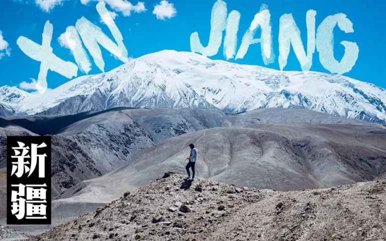
Xinjiang Photography: Best Spots for Landscape Photographers
Why Xinjiang Is a Landscape Photographer’s Dream
Few places on Earth deliver the sheer topographic range of Xinjiang. In a single week you can shoot glacier-fed alpine lakes, endless grassland folded into river valleys, rust-red canyon walls, and Central Asian mud-brick architecture that has barely changed in five centuries. For landscape photographers, this is the equivalent of a private playground — but only if you know when to be where, and how to work with the extreme seasonal light.
Whether you are planning your first Silk Road photo expedition or refining a returning itinerary, the curated guide at Xinjiang Travel Tips covers the practical details that make the difference between a good shot and a great one.
1. Sayram Lake — The Ice-Blue Mirror at 2,000 Meters
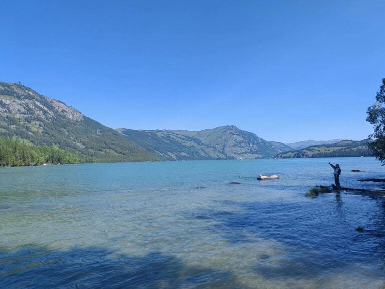
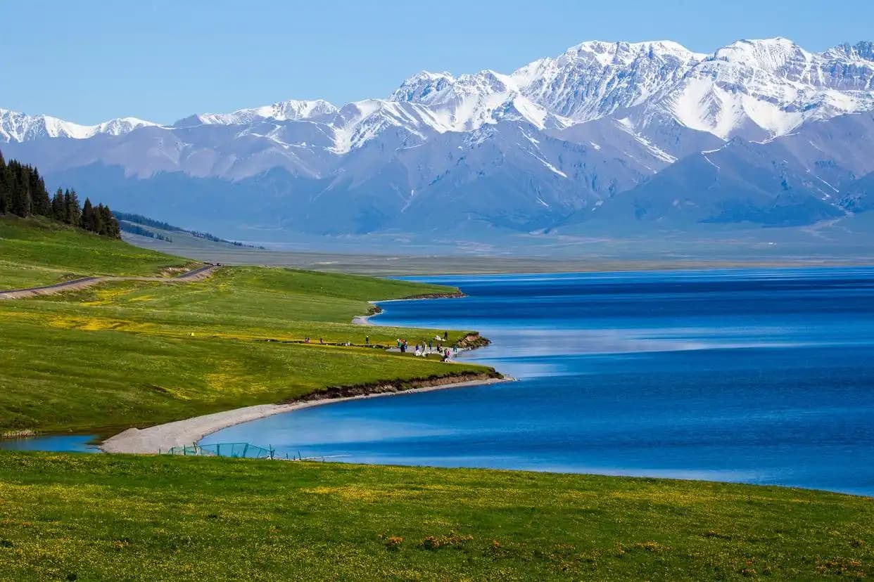
Sayram Lake (赛里姆湖) is Xinjiang’s largest alpine lake, perched at 2,073 meters in the Bortala corridor. Because it is oligotrophic — nutrient-poor and ice-fed — the water shifts through an impossible range of blues depending on cloud cover, wind, and the angle of the sun. On a still morning after rain, the surface goes electric cyan. Three hours later, with high cloud, it turns slate-grey with silver highlights.
The ring road (about 90 km) hugs the shoreline with pull-offs every few kilometers. The west platform gives you the wide-angle classic; the southeast inlet, reachable by a short walk from the road, is where the steppe grasses catch golden light in September. If you are a sunrise photographer, arrive at the lake shore by 6:00 AM in high summer — the first light hits Bogda’s distant ridgeline and races across the water toward you.
Seasonal notes: late May to June for wildflower fringes along the south shore; July to August for peak saturation blue; September for crisp air and golden steppe. The detailed seasonal breakdown on our site helps you time your visit to the exact week.
2. Kanas Lake & The Three Bays — Decoding the “God’s Garden”
If Sayram is about scale, Kanas (喀纳斯) is about intimacy. The glacial lake sits in the Altai Mountains at 1,374 meters, surrounded by Siberian taiga and folded mountain ridges. The famous “three bays” — Shenxian Bay (神仙湾), Moon Bay (月亮湾), and Wolong Bay (卧龙湾) — are not the same location. They are a 10-kilometer chain along the Kanas River downstream from the lake, each with a completely different photographic character.
Shenxian Bay is the mist shot. You need to be there at first light — not 9:00 AM, not even 7:30. We are talking 5:30 to 6:00 AM in September. The river channels braid through a shallow wetland, and as the sun touches the far ridges, layered fog ribbons rise and dissolve in sequence. It is one of the most layered compositions available in China.
Moon Bay is the iconic crescent. The best vantage is from the wooden stairs that lead down from the road, about 10 minutes’ walk. In September the birch flank turns gold, and if the wind is calm the curve mirrors perfectly. Wolong Bay, broader and flatter, works well as a picnic stop with a moderate telephoto compression of the “reclining dragon” sandbar.
Guanyu Terrace (观鱼台), reachable by shuttle then a 1,066-step climb or escalator, gives you the overhead S-curve of the lake itself. Bring a polarizer — the glare off glacial-flour water is intense by late morning.
3. Bayanbulak Grassland & The Nine-Bend River Sunset
Bayanbulak (巴音布鲁克) is the shot that made Xinjiang famous on social media — and for once the reality matches the image. The Kaidu River loops and knots itself into a formation known as the “Nine-Bend” (九曲十八弯) across a high alpine basin at 2,500 meters. On a clear evening, as the sun drops behind the Tianshan spine, the river’s multiple curves can reflect the sky in seven or eight separate ribbons of fire-gold.
The designated overlook platform is the only legal shooting position, and it fills up. Arrive 60 to 90 minutes before sunset to claim a railing spot with a clear forward angle. A 24–70 mm lens is the workhorse here; a 70–200 mm lets you compress the river bends dramatically.
Practical warning: Bayanbulak sits in a high wetland, and the mosquito population in July and August is legendary. Bring DEET 30%+, and consider a bug-net hood for the platform at dusk. The practical travel guides on our site include a full packing list for this exact scenario.
4. World Devil City — Yadan Formation at Golden Hour
An hour’s drive from Karamay, the World Devil City (世界魔鬼城) is a Yadan erosion landscape — wind-sculpted sandstone towers and ridges spread across a basin so vast it feels unnatural. The name comes from the eirie howling the wind makes through the formations, especially at dusk.
The site is accessible only by the park’s mandatory sightseeing bus, which hops between numbered stops along a one-way loop. Stop 4 and Stop 6 are the most photogenic — taller formations with better side-light in late afternoon. The copper-red sandstone glows in the 90 minutes before sunset; by midday the light is flat and the heat is punishing.
A quick note on drones: they are restricted or prohibited in most zones. Ask at the ticket office before launching anything. The wind out on the plain is no joke — secure hats and lightweight gear.
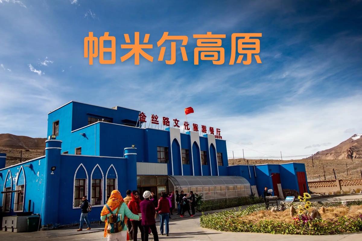
5. Karakul Lake & Muztagh Ata — The Pamir Plateau’s Crown Jewel
At 3,600 meters on the Pamir Plateau, Karakul Lake (卡拉库尔湖) delivers a landscape that feels genuinely Himalayan-alpine. The water shifts from jade-green to steel-blue depending on cloud and angle, and the snow-white massif of Muztagh Ata (7,546 m) provides the backdrop that makes every frame look like a portfolio piece.
The classic composition is from the northeast shore track looking south at Muztagh Ata mirrored in the lake. Best light: dawn (the air is clearest after nighttime radiative cooling) and 90 minutes before sunset. If you stay overnight in a Kyrgyz yurt camp on the north shore, you can shoot both sunrise and sunset without a long drive.
Altitude safety is non-negotiable here. Never ascend directly from Kashgar (1,280 m) to the lake and exert heavily on the same day. Spend a night in Kashgar first to acclimate. Symptoms of altitude sickness — headache, nausea, dizziness — mean descend immediately.
6. Nalati Grassland — Folding Terrain and Spruce Gorges
Unlike the flat, endless steppe of Bayanbulak, Nalati (那拉提) is folded terrain — ridges, ravines, and spruce gorges that create layers of green. The Sky Prairie (空中草原) zone is the classic postcard: rolling crests, grazing sheep, and distant snow. For photographers, the upper overlook deck on a clear morning delivers the signature panorama with layered depth that separates foreground, mid-ground, and infinite background.
The Valley Grassland (河谷草原) zone is flatter and river-threaded, with fewer crowds. It works well for picnic-style wide shots and horse-riding action frames. If you are visiting in June or July, wildflowers dot the meadow edges — use a wide aperture to isolate a single bloom against the grassland sweep.
Gear and Timing — What Actually Matters
Xinjiang’s light is intense. At altitude the UV index is punishing, and the dry air means you lose more water than you think. Here is the gear checklist that consistently makes the difference:
- Circular polarizer (CPL): Essential for cutting glare on lake surfaces and deepening blue skies. Stack it with a UV filter for lens protection.
- Neutral Density (ND) filter: Useful at Sayram or Kanas if you want to slow water to silk in broad daylight.
- Sturdy tripod: Not optional. The wind at Devil City and on open grasslands will blur a handheld shot at any shutter speed.
- Extra batteries (3+): Cold at altitude drains Li-ion cells fast. Keep one in an inner pocket.
- Wide-angle (16–35 mm) and mid-telephoto (70–200 mm): The two-lens kit that covers 90% of Xinjiang landscapes.
Timing your trip is as important as packing the right glass. The itinerary planning resources on our site break down exactly which week of which month delivers the best light for each region — because “summer in Xinjiang” is a six-month window, and showing up in the wrong three days can mean dust storm instead of golden hour.
Respecting What You Photograph
Xinjiang is not a theme park. The old city lanes, the yurt camps, the monastery ruins — these are lived-in places. A few principles that earn you better access and better images:
- Always ask before photographing people. A smile and a raised-eyebrow gesture works across the language gap.
- Don’t step on fragile wetland boardwalks or trample flower meadows for a “better angle.” The shot is not worth degrading the place.
- Mosques and active heritage sites have their own rules. The “no photo inside” rule exists to protect pigment and preserve irreplaceable art — not to be annoying.
- If you are invited into a yurt or a home for tea, accept gracefully and offer a small tip (¥20–50) on departure.
Putting It All Together — A Sample 7-Day Photography Itinerary
For landscape photographers with one week, here is a pacing that actually works (not the impossible “see everything” loop that ruins the light):
- Day 1: Arrive Urumqi, pick up rental 4×4, drive to Heavenly Lake (Tianchi), shoot late afternoon from west shore plank trail.
- Day 2: Drive to Yining via Guozi Gorge, afternoon at Sayram Lake west platform for sunset.
- Day 3: Sayram sunrise, then drive to Kanas (long drive, break it up), overnight in Jiadenyu.
- Day 4: Kanas core — Shenxian Bay sunrise, Moon Bay morning, Guanyu Terrace afternoon.
- Day 5: Drive to Bayanbulak via Muzart Valley, arrive before sunset for Nine-Bend platform.
- Day 6: Bayanbulak sunrise (swan lake boardwalk), then drive to Kuqa via Tianshan Grand Canyon.
- Day 7: Kuqa area — Subash Ruins morning light, then Kizil Caves for cultural context.
This is aggressive but doable if you are comfortable with 3–5 hours of driving on mountain pavement per day. If you want to slow it down and shoot more deeply in fewer locations, the custom itinerary guides on our site walk through several alternative pacing options.
The Bottom Line
Xinjiang is not a subtle destination. The landscapes are big, the light is hard, and the distances will test your planning. But if you time it right, pack the right gear, and respect the places and people you are photographing, the images you bring home will be unlike anything in your existing portfolio. Start with one region — north or south, lake or desert — and let the place pull you back for the rest.