The Wusun Ancient Road: Trekking from Ili to Kuqa Across the Tianshan
There is a footpath in Xinjiang that almost no tourist bus will ever reach: the Wusun Ancient Road (乌孙古道), a high Tianshan crossing that once linked the Ili valley in the north to the oasis of Kuqa in the south. I walked part of it on a press trip a few years back, and the moment you crest the pass and see both a glacial river and a desert horizon in one glance, you understand why caravans risked it for two thousand years.
Who Were the Wusun?
The Wusun were a nomadic confederation that dominated the Ili valley and the northern Tianshan roughly from the 2nd century BCE. They were neighbors and sometimes rivals of the Xiongnu and the Han, and their territory sat squarely on the Silk Road’s northern branch. The “ancient road” named for them is less a single paved route than a network of seasonal passes herders and traders used to move people, horses, and goods between the wet north and the dry Tarim basin.
Today the most hiked segment runs from the Bayinbulak grasslands area, up over the Aksu / Dalabute pass, and down toward Kuqa. It is a genuine multi-day trek, not a day walk — and that is exactly its appeal.
The Route in Stages
Conditions change yearly with snowmelt, but a typical south-bound crossing looks like this:
| Stage | From → To | Notes |
|---|---|---|
| 1 | Bayinbulak → base camp | Gentle grassland walking; yak and horse traffic |
| 2 | Base camp → pass | Steep climb; altitude peaks near 3,500–4,000 m |
| 3 | Pass → northern river valley | Long descent through alpine meadows |
| 4 | Valley → Kuqa foothills | Dry, rocky; exit onto the southern road |
This is not a route to underestimate. Even in summer, the pass can hold snow, and river crossings swell after rain. Most people attempt it with a local guide and pack animals.
Permits, Season, and Prep
| Factor | Recommendation |
|---|---|
| Best season | Mid-June to early September (after snowmelt, before first snow) |
| Permits | Border-area paperwork often required; arrange via a licensed local operator |
| Fitness | Multi-day trekking fitness; comfortable at 3,500 m+ |
| Gear | Four-season sleeping bag, rain shell, crossing sandals, GPS |
| Guide | Strongly recommended; the route is unmarked in places |
If a 4-day trek is more than you want, the Nalati grassland on the northern side gives you a taste of the same landscape by car and boardwalk, with none of the exposure.
Why It Matters for Travelers
You do not have to walk the whole thing to appreciate it. Driving the modern highways that parallel the old corridors — the G217 and the Duku Highway — you cross the same watershed the Wusun did, just in a climate-controlled car. Stopping at the Bayinbulak wetlands or the Kuqa side canyons lets you feel the route without the risk.
Pairing It With an Itinerary
Because the road connects the Ili valley to the southern Silk Road, it pairs naturally with a north-to-south plan. Our itinerary planning guide shows how to chain Ili, the Tianshan passes, and Kuqa into one logical loop.
Respect and Leave No Trace
The Wusun road crosses pastureland still used by Kazakh and Mongol herders. Camp below the grass line where possible, pack out all trash, and ask before photographing families or livestock. The route’s magic is its wildness — keeping it that way is everyone’s job. Operators who run the route responsibly will brief you on both the ecology and the local etiquette before you set off; choose those, and skip anyone promising a fast unsupported crossing.
What You’ll See Along the Way
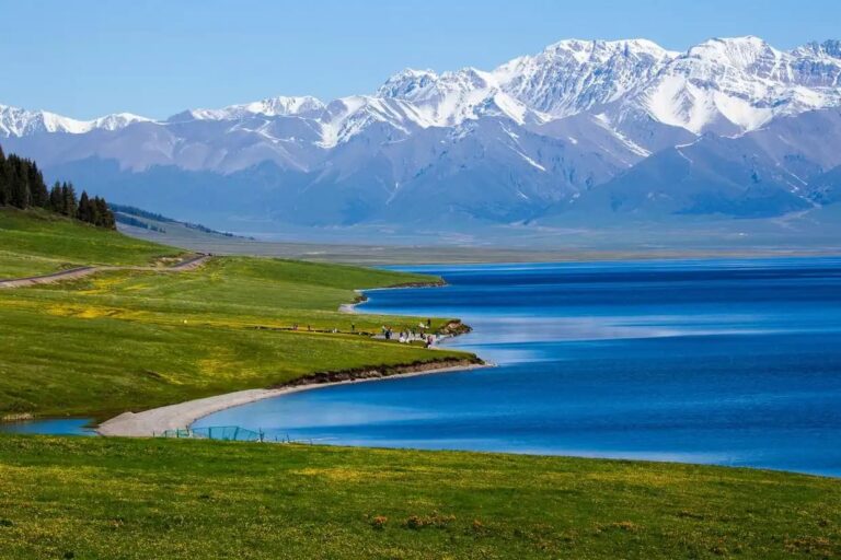
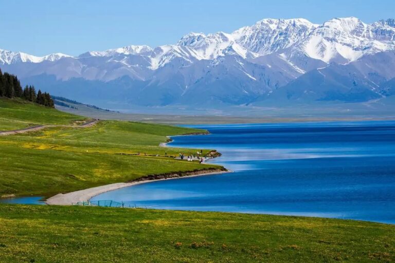
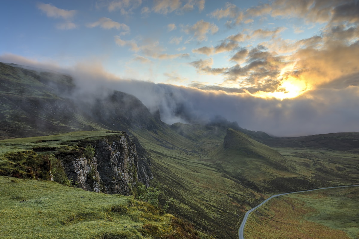
The crossing is a compressed geography lesson. The northern approach runs through Bayinbulak’s high wetland — China’s largest alpine swan reserve, where the Kaidu River braids into nine bends. Climbing toward the pass, grass gives way to scree and then snow. On the southern descent you drop through fir and spruce forests into the red-rock canyons that announce you are entering Kuqa’s territory, near the Kizil caves and the southern Silk Road. Few single treks show that much ecological range in four days.
Wusun Road vs. the Duku Highway
The Duku Highway is the famous drive that also crosses the Tianshan, and many travelers assume it is the ancient road. It is not the Wusun route, but it is the modern echo of the same logic: connect the wet north to the dry south. If you cannot trek, drive Duku for the vistas; if you can, the Wusun footpath gives you the version without an engine. Both reward the same appetite for altitude and open space.
Cultural Sites at Each End
The trail’s endpoints sit next to serious history. In the north, Ili (Yining) was a 19th-century frontier garrison town with Russian-influenced architecture and famous lavender fields. In the south, Kuqa was the ancient kingdom of Qiuci, home to the Kizil Caves — the oldest major Buddhist cave art in Xinjiang. Walking the Wusun road literally connects two of the Silk Road’s most important cultural poles, which is part of why historians love it.
When Not to Go
Skip the shoulder seasons. May still has deep snow on the pass and unreliable river crossings; October can bring the first winter storms with no rescue infrastructure on the route. The comfortable window is genuinely narrow, which is why local operators run trips in a tight mid-summer band. If you are flexible, aim for late July or August, when both the grasslands and the high pass are most accessible.
Flora and Fauna on the Crossing
The Wusun road passes through several life zones, so the wildlife changes as you climb. Near Bayinbulak look for the swans the reserve protects, plus marmots whistling from the grass. Higher up, blue sheep (bharal) graze the scree and golden eagles ride the thermals above the pass. On the southern desert edge, you may see goitered gazelle and a surprising amount of birdlife along the river courses. None of this is guaranteed — the animals are wild and shy — but the range of habitats in a single crossing is the quiet reward for the effort. Bring binoculars if you have them; even a basic pair turns the high pass from a slog into a safari, and it freezes the memory of the swans long after you are back home.
Before you go: the things that matter
- Hiking the wusun ancient road independently — Technically some attempt it, but a licensed local guide is strongly advised for safety, navigation, and permit handling.
- Timing — Typically 4–6 days depending on fitness, snow conditions, and whether you use pack animals.
- Dangerous — The main risks are altitude, cold, river crossings, and getting lost.
- Needing a border permit — Often yes — parts of the corridor sit near sensitive areas.
- Closest town with hotels — On the north, the Bayinbulak area and the town of Yining (Ili) are bases.
Work through that list a few days before departure, not on the morning you fly. Most of the grief I have seen on this route comes from leaving it until the last minute.