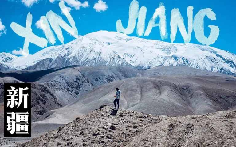
Top Xinjiang Tourism Places
Your definitive roadmap to the most extraordinary Xinjiang tourism places on Earth — written for independent travellers who want the real thing, not a rehearsed group tour.
Why Xinjiang’s Places Hit Different
Most travellers think “China” and picture Shanghai skyscrapers or Guilin karst peaks. Then they land in Xinjiang — China’s sixth of the map, half the size of Western Europe — and realise they’ve walked into a completely different world.
One day you’re standing on a 2,000-year-old Silk Road fortress at 3,000 metres where the wind hasn’t changed direction in centuries. The next you’re eating cumin-dusted lamb skewers in a mud-brick old city that looks like a film set. Then you’re staring at glacial-teal water so bright it looks filtered, surrounded by Siberian taiga where snow leopards still roam on paper.
That’s the thing about Xinjiang tourism places — they don’t compete with each other; they stack. Every region here is a different civilisation, a different climate, and a different century. The trick isn’t seeing “everything” (impossible in one trip). It’s choosing the right combination so the scale works foryou, not against you.
This guide walks through the 10 definitive places every foreign traveller should build around, then shows you how to stitch them into itineraries that actually work on the ground.
The 10 Definitive Xinjiang Tourism Places
1. Kashgar Old City (Kashi) — Where the Silk Road Still Lives
The history in one sentence: Kashgar has been a crossroads for over 2,000 years — sitting at the collision point of the Silk Road’s northern and southern routes, where Central Asian caravan culture never really left.
What you’re actually walking into: Not a “heritage site” — a living city of roughly 130,000 people whose old core is a labyrinth of sun-dried brick, carved poplar beams, and alleyways that twist like a conscious decision notto be a grid. The Id Kah Mosque (艾提尐尔) anchors it. The Sunday Livestock Market (5 km out) sells the kind of raw, unedited tradition you can’t fake.
The moments that stick:
- Morning light hitting the city wall walkway as tea steam rises from rooftop chaykhana
- Getting lost (deliberately) in the multilevel alleys between Boyi Road and the mosque quarter
- The night food street — lamb skewers, naan, pomegranate juice, and a crowd that spans every trade route
Practical reality: Safe, heavily present police infrastructure (this is goodfor traveller safety), warmly hospitable once you show basic respect. Dress modestly at the mosque. Smile + hand gesture before photographing people.
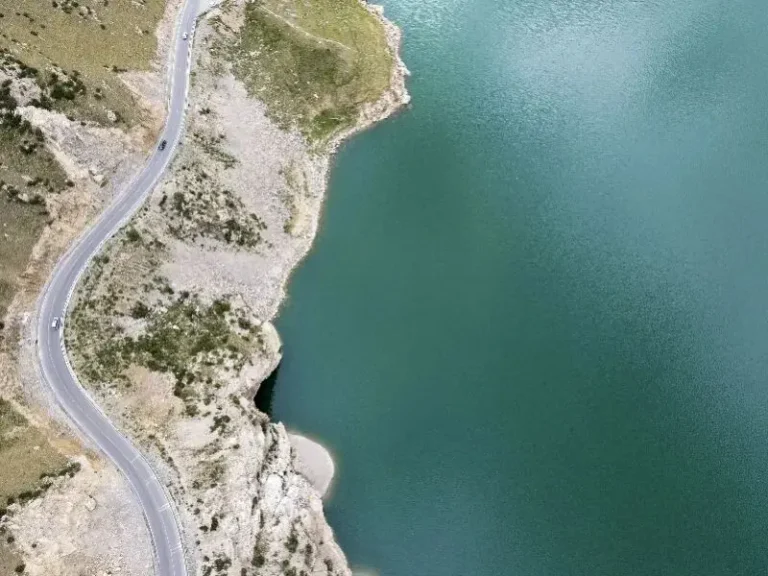
2. Karakul Lake & the Pamir Highway (Muztagh Ata Country) — The Roof of the World
The history: This is the ancient “Stone Tower” corridor — the fabled western gate where Ptolemy placed a trading post and where Sogdian merchants funnelled silk toward Samarkand and Balkh. Today it’s the dramatic high-altitude approach to Tashkurgan, framed by Muztagh Ata (7,546 m).
What you see: A sapphire lake at ~3,600 m, ringed by alpine scree and snow peaks that don’t look real even when you’re shivering next to them. The Golden Grass Beach (金草滩) near Stone City turns amber at sunset in a way that justifies every terrible “bucket list” cliché.
The non-negotiable: You must have your border-zone permit (边防证) processed in Kashgar before driving south. No permit = turned back at the checkpoint. Altitude hits fast — sleep in Kashgar first, hydrate, don’t sprint up slopes.
3. Tashkurgan — Stone City & Pamir Tajik Heritage — 2,000 Years of Stone Tower
The history: The name Tashkurganmeans “Stone Fortress” in Persian/Uyghur. This was the fortified node controlling access between the Alai and Pamir valleys — the literal customs house of antiquity. The stone citadel ruin still occupies its ridge at 3,090 m, and the surrounding Pamir Tajik community keeps alive one of the most distinct cultures in China: high-altitude agriculture, yak-dairying, and a hospitality code as old as the walls.
Why it belongs in every serious list of Xinjiang tourism places: Because it’s the only place where “ancient history” and “active indigenous culture” sit in the same frame — and the wind never lets you forget the altitude.
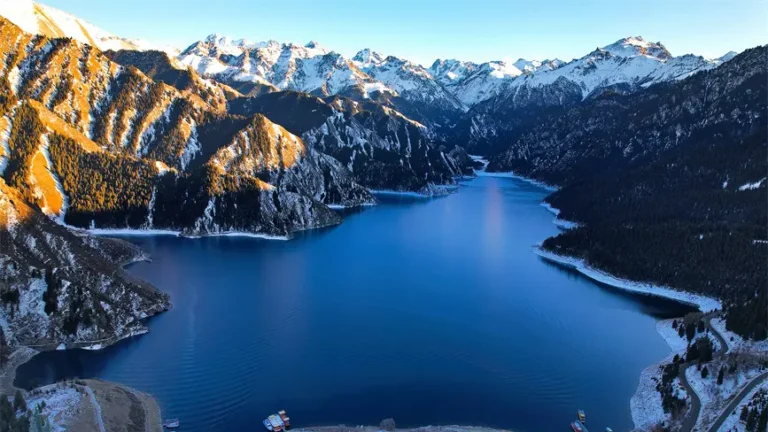
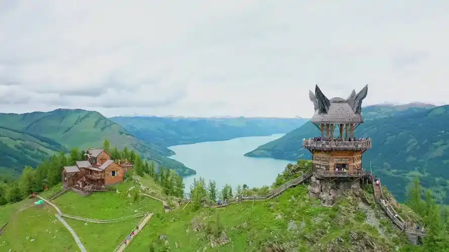
4. Kanas Lake & The Three Bays (Shenxian Bay, Moon Bay, Wolong Bay) — “God’s Garden” in the Altai
The history: The Kanas biosphere protects Siberian taiga, glacier-fed waters, and the Tuvan/Uriankhai mountain-heritage villages in the Altai Mountains. The lake’s colour shifts through jade → teal → milky turquoise depending on glacial flour load — pure optics, pure geology, zero filters needed.
The sequence that works:
- Guanyu Tai (观鱼台) — the cliff-edge overlook where the S-bend and the “lake monster” lore live
- Moon Bay — the crescent curve, golden in September
- Shenxian Bay — morning mist if you stay overnight inside(day-tripping this at 07:00 from Jiadenyu is a stressful sport; overnight is the luxury)
- Hemu Village — timber-log cabins, birch gold, smoke at dawn
Rule: Kanas is best mid-September to early October. July is green and warm, but September is theimage.
5. Sayram Lake — The Last Tear of the Atlantic
The history / geography: At 2,073 m in the northern Tianshan, this is Xinjiang’s largest alpine lake — an oligotrophic (nutrient-poor), ice-fed sapphire basin ringed by snow peaks that “shouldn’t” exist this far inland. The Mongol name ties to Tengri(“sky”) traditions.
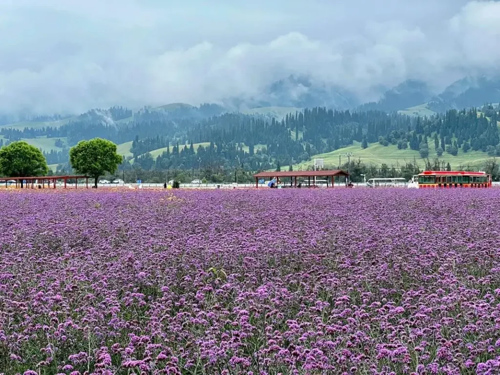
The experience: A 90 km lakeside ring road with pull-offs every few kilometres — glacier viewpoints, nomad tents, and a water-colour that swings from slate-grey to electric cyan as clouds roll. Combine it with Guozi Gorge (果子沟大桥) and, in mid-June, Huocheng lavender fields for a day that stacks three completely different visuals.
Practical: Expect a scenic-area fee/pass regime at the gate; self-drive on the lakeside highway is typically allowed with the daily vehicle pass (policy adjusts year-to-year — confirm on arrival).
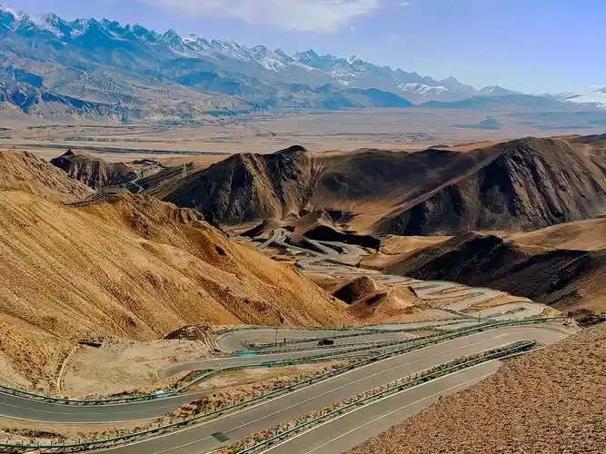
6. The Duku Highway (G217: Dushanzi ↔ Kuqa) — The Most Scenic Road Trip in China
The history: 561 km of engineered audacity across the Tianshan spine — connecting northern Xinjiang’s grassland basins to the southern desert basins. 168 road builders died building it; there’s a martyr cemetery at Qiaolma most drivers don’t expect to be moved by.
What makes it a top-tier Xinjiang tourism place: You cross 3,390 m Hashilegen Pass (snow possible even in July), drop past alpine meadows, cliff-hanging switchbacks at Tiger Mouth, and deep red canyon country — all in one day of driving. It’s not a “stop”; it’s a corridor that isthe attraction.
The rules you must respect:
- Open roughly June–early October only (weather-dependent; watch the official transport bureau announcement each year)
- 7-seat limit on passenger vehicles for the full line
- Night closures — you don’t “wing it” after dark in the mountains
7. Bayanbulak Grassland & the Nine-Bend River Sunset — China’s Second-Largest Grassland, Frozen in Time
The geography: ~2,500 m in Bayin’gholin Prefecture — a high alpine basin so flat and wide the Kaidu River folds back on itself nine ways. The swan marsh (天鹅湖) in warm months is one of the few places in Xinjiang where “wetland” feels truly tender rather than hostile.
The icon: The Nine-Bend sunset — where the river catches low-angle light and turns the whole basin gold-green. You need the official shuttle/loop system and patience with weather (it’s high, it’s windy, and clouds love this basin).
Heads-up for foreign travellers: Bayanbulak sits in a sensitive administrative zone; foreigner-access rules have historically been stricter than standard tourist spots. Always verify current opening status with your Kashgar/Urumqi agent before routing your entire itinerary through it.
8. Turpan: Grape Valley, Karez System & the Ingenuity of the Desert — Civilisation Where It Shouldn’t Exist
The history: Turpan is the hottest, driest, lowest major oasis in China (~−154 m at Aydingkol). What makes it a must among Xinjiang tourism places isn’t “scenery” — it’s human ingenuity: the Karez (坎儿井) underground canal system, dating back over 2,000 years, that steals snowmelt from the Tianshan foothills and delivers it silently under the desert to grape arbors and mud-brick courtyards.
What to stack in one perfect Turpan day:
- Morning: Jiaohe Ancient City (earth’s best-preserved mud-brick city) — 09:00–11:00 light
- Midday: Karez Folk Gardens (cool, shady, educational)
- Afternoon: Grape Valley for the microclimate and the vine-draped courtyards
- Evening: Flaming Mountains marker for the colour, then back to town for naan + laghman
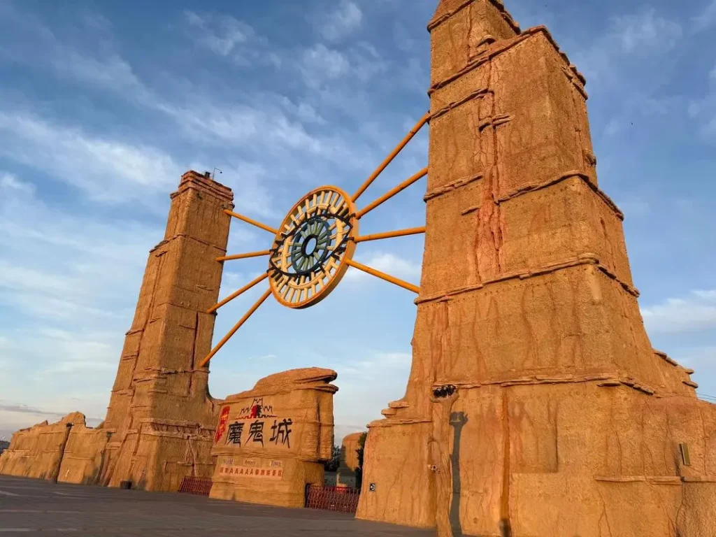
9. World Devil City: Wuerhe Yadan National Geopark — Mars, But With Wind
The geology: On the northwest edge of the Dzungarian Basin near Karamay, millions of years of wind erosion carved soft sedimentary rock into towers, castles, and animal silhouettes across a rust-red basin. On windy days, the air sings through the formations — hence “devil” (it’s an acoustic illusion, not a curse).
Why it earns a slot: Because after all the “blue lake + green mountain” imagery, you need one place that reminds you Xinjiang can also look like an abandoned planet. Sunset is the power hour — the red turns copper, the shadows sharpen, and the scale finally lands.
Logistics: ~1.5 hrs from Karamay; shuttle system / walking loops clearly signed; water + sun protection essential.
10. Bezeklik & Gaochang — The Buddhist Art Highway Out of Turpan
Bezeklik Thousand-Buddha Caves: Carved into a Flaming Mountain cliff face, these 5th–14th century grottoes were a Buddhist art powerhouse on the Silk Road — today you come for the setting (copper canyon light) and the surviving fragments that still whisper of the Sogdian–Tocharian–Uyghur cultural stack.
Gaochang Ancient City: 163 hectares of tamped-earth ramparts and palace-platform ruins 46 km east of Turpan — the “sprawling capital” to Jiaohe’s “intact maze.”
How to do it: Morning Gaochang → late morning drive the canyon approach to Bezeklik → afternoon back via the Flaming Mountain scenic marker. It’s a half-day that connects ruin + art + desert light better than anything else on the map.
How to Chain These Into Realistic Itineraries (Not Fantasy Math)
The biggest mistake foreigners make with Xinjiang tourism places is underestimating distances. Urumqi → Kashgar is roughly 1,500 km. You don’t “pop over.”
Itinerary A — The Classic South (8–10 Days, Fly-In/Out of Kashgar)
Kashgar → (permit) → Karakul & Tashkurgan (2D) → back to Kashgar → fly to Urumqi → high-speed/train to Turpan (1D) → fly out
Best for:First-timers who want Silk Road density without burning out.
Itinerary B — The Northern Loop (10–12 Days)
Urumqi → Sayram Lake day → Ili Valley (2D) → fly/overland to Altay → Kanas/Hemu (2–3D) → back to Urumqi
Best for:Landscape addicts who want lakes, taiga, and golden birch.
Itinerary C — The Duku Crossing (Minimum 3 Days, Summer Only)
Urumqi → Dushanzi → (Duku) → Bayanbulak (if open/verified) → Kuqa → Bezeklik/Gaochang → Turpan → Urumqi
Best for:Drivers/road-trippers who want the Tianshan spine. Requires timing the June–Sept window precisely.
The Practical Wisdom No One Puts in Brochures
- Your passport is your most-used item. Hotels, train stations, airport-style security at landmarks — carry it in a zip pocket, not buried in luggage.
- The “foreigner” filter is mostly about paperwork. Most headline Xinjiang tourism places are fully open — the friction lives in border zones (Tashkurgan permit, occasional checks). Sort the permit in Kashgar and 90% of anxiety vanishes.
- July heat is no joke in Turpan & the Tarim basin. 42–48°C happens. Do outdoor sites early or late; hydrate like it’s your job.
- Food is the best history lesson. Every kebab, every bowl of laghman, every triangular samsa pulled from a clay wall is a primary source. Eat where the locals eat — the second-tier family-run Uyghur dining rooms are the soul of the trip.
Final Word
The magic of Xinjiang tourism places isn’t that they’re exotic. It’s that they’re simultaneouslyancient and alive — civilisations layered like sediment, still humming, still trading, still feeding travellers who know how to show up right. Build your route with the distances respected, the permits sorted, and the appetite switched on. The rest sorts itself out.