Drone Photography in Xinjiang: Rules, Permits, and Where Flying Is Banned
What sets this place apart
Xinjiang’s landscapes are a drone operator’s dream: mirror-still lakes, infinite dunes, snow peaks, and ancient mud-brick towns seen from above like a painter’s composition. Many of the region’s most iconic shots, from the nine bends of the Kaidu River to the blue arc of Sayram Lake, are essentially aerial photographs. But flying a drone here is not as simple as launching in a park. Xinjiang is a sensitive border region with active military installations, restricted airspace, and strict enforcement. This guide explains the real rules, the permits you may need, and the places where flying is simply off-limits.
Understanding the framework before you travel saves you from confiscated gear, fines, or worse. The short version: register your drone, expect bans near borders and cities, and always ask locally before takeoff. Aerial footage is worth it, but the privilege depends entirely on flying responsibly within the law, and a single careless launch near a checkpoint can end a whole trip and sour every interaction that follows. Treat the rules as part of the craft, not an obstacle to it.
This matters more here than almost anywhere else in the world. The same geography that makes Xinjiang spectacular, its position on remote frontiers, is exactly what makes its airspace tightly controlled.operators who arrive assuming the rules of a European lake apply will be unpleasantly surprised. The travelers who come prepared, with registration done and expectations set, are the ones who fly home with the reel everyone envies.
Getting there and the distances
Most drone travelers base themselves in Urumqi and fly out to shooting locations, or rent a car and treat the region as a rolling aerial shoot. If you are bringing a drone from abroad, note that Chinese customs may inspect it and that models above a certain weight require registration with the Civil Aviation Administration. Carry your purchase receipt and any home-country registration; having paperwork smooths entry and answers questions at the border, where officers sometimes ask pointed questions about electronic equipment and its intended use.
Domestic flights within Xinjiang accept drones in checked baggage, but lithium batteries must go in carry-on under airline rules. Pack your drone in a padded case, and never check the batteries. At smaller airports like Kashgar or Altay, security screening is thorough, so allow extra time and keep the device accessible for inspection. A hard case with custom foam also protects against the rough handling common on remote routes, where your bag may ride in a roof box for hours over washboard roads that would rattle a loose propeller into ruin.
When you land, resist the urge to test the aircraft in the airport parking lot. Wait until you have spoken to your hotel or a local operator about current conditions. The few minutes of patience cost you nothing and may save you from a first-day mistake that sets the tone for the whole visit. Many scenic towns have unofficial no-fly understandings that only a local can explain.
Choosing months
Autumn, especially late September through October, offers the cleanest air and most dramatic color, with golden birch against blue sky and snow-dusted peaks. Spring brings apricot blossoms in the Ili Valley but also dust storms that ground flights for days, so build buffer into any spring shoot. Summer is flyable but hazy in the basins and crowded at popular sites, which raises the chance of no-fly orders during events and festivals held near the lakes when security tightens.
Wind is the hidden variable. Xinjiang is famously windy, and many scenic areas sit at altitude where gusts exceed safe limits for consumer drones. Plan flights for early morning, when air is calm and light is soft, and treat afternoon wind as a no-fly condition more often than not. Checking a local wind app at dawn is part of the daily routine for serious aerial shooters here, and a wasted trip to a viewpoint is better than a lost aircraft in a gorge with no cell signal to call for help.
What is actually worth seeing
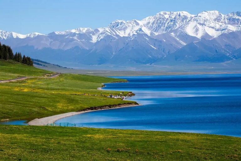
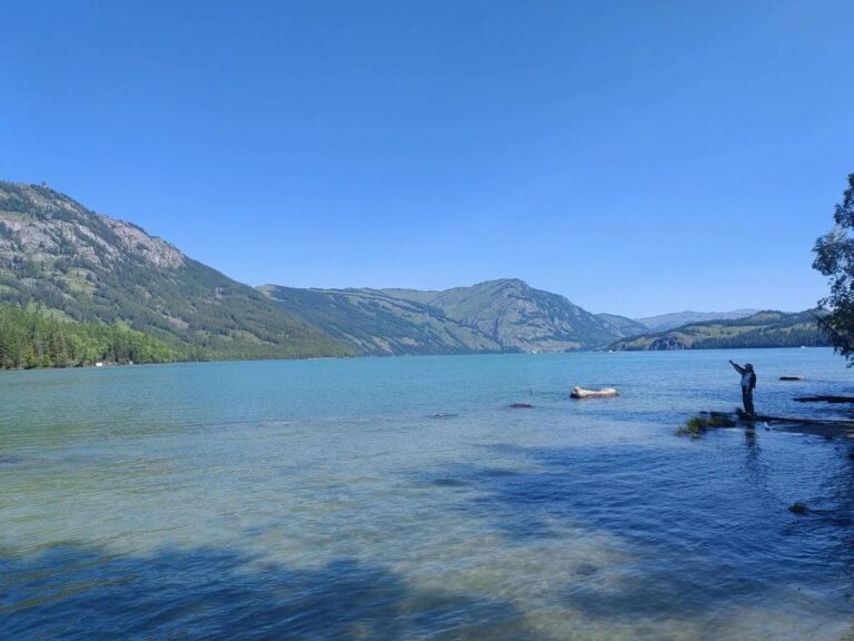
The classic drone targets are the alpine lakes, Sayram and Kanas, where aerial views reveal shapes invisible from shore. The grasslands of Nalati and Bayanbulak, the latter famous for the winding Kaidu River, are spectacular from above, especially at the golden hour when the water catches the light and the nine bends glow like a ribbon dropped on green felt. The Panlong Ancient Road’s 600 switchbacks are a legend in aerial footage, and the desert highways crossing the Taklamakan show the romance of the Silk Road at scale, a thin line of asphalt crossing an ocean of sand.
Less obvious but rewarding are the oasis towns of the south, where rooftop patterns and mosque geometry reveal themselves only from height. The vineyards around Turpan and the grids of the Ili farmlands also make striking abstract compositions, especially when morning shadow draws the rows into bold relief. Always scout on foot first to understand the terrain and any hidden restrictions posted at the gate, and note takeoff points that keep you clear of crowds, roads, and the ever-present herders with nervous livestock who will not appreciate a buzzing visitor.
Remember that the best frame is worthless if it breaks the law. Many operators plan two versions of every shoot: the legal wide shot from a permitted zone, and the closer detail they capture on foot with a zoom lens. Flexibility keeps you flying and out of trouble, and often the ground-level shot surprises you more than the one from the sky. Some of my favorite Xinjiang images were taken with the drone still in the bag.
What makes it easier
Register your drone with the CAAC system before arrival if possible, and keep the approval on your phone. Stay below 120 meters, keep visual line of sight, and avoid flying over crowds, roads with moving traffic, or any structure that looks official. Carry spare props and batteries; cold drains cells fast at altitude, so keep spares warm in an inside pocket and rotate them between flights to extend your session and avoid a dead aircraft at the worst moment, with the light fading and the car still an hour away.
Never fly near military zones, border fences, or airports, and respect any verbal instruction from rangers or police immediately. A good habit is to ask at your hotel or the scenic area ticket office whether drones are permitted that day; rules change with local events and security postures, and a five-minute question prevents a five-hundred-yuan mistake. When in doubt, land, and do it calmly so you never appear to be fleeing, which is the fastest way to attract unwanted attention from someone with a radio.
Back up your footage every night. Dust, vibration, and the sheer number of shots mean card failure is a real risk, and you do not want to lose a once-in-a-lifetime Kanas sunrise. A small SSD in your bag is worth its weight, and a habit of offloading each evening turns a fragile memory card into a permanent archive of the trip, safe even if the drone is lost, stolen, or confiscated at a checkpoint you did not expect.
What is within reach
Near Urumqi, Heavenly Lake permits careful flying in designated spots and offers a quick test of conditions close to help. In Kashgar, the old city itself bans drones, but the surrounding Pamir approach has open areas where responsible flight is possible with local permission and a clear line of sight. The Ili Valley’s lesser-known grasslands often have fewer restrictions than the headline sites, making them a relaxed place to practice your technique before the dramatic, restricted edges of the region where a mistake carries real consequences.
For a controlled introduction, pair a permitted flight at a major lake with a ground-level walk along the shore; the contrast teaches you what the drone adds and what only your feet can capture. Build skill in easy zones before attempting the dramatic, restricted edges, and you will come home with both safer flying and better pictures. The pilots who last in this landscape are the patient ones, not the daring ones.
The things I would keep
Drone photography in Xinjiang can produce once-in-a-lifetime images, but the privilege comes with responsibility. Register, research, ask, and back off when told. The best Xinjiang aerials come from patient operators who respect the rules and the place, not from those who push boundaries. Fly legal, fly safe, and the skies are yours to capture, one calm morning at a time, with a memory card full of frames that no one else managed to get.