Dushanzi Grand Canyon: The Red Earth Miracle of Northern Xinjiang
Setting the scene
The Dushanzi Grand Canyon, carved by the Mayile and Kuytun rivers into the northern flank of the Tianshan, is one of northern Xinjiang’s most dramatic and least crowded red-earth landscapes. Sometimes called the ‘Sailimu of the earth’ for its layered strata, the canyon drops in steep walls of rust, ochre, and grey, cut by millennia of meltwater flowing down from the mountains toward the Junggar Basin.
What makes it special is the combination of scale and solitude. Unlike the busy canyon near Kuqa, Dushanzi remains off most tour itineraries, which means you can stand at the rim with only the wind for company. For photographers and road-trippers crossing between Urumqi and the Ili Valley, it is a spontaneous highlight that costs little more than a detour and a pair of steady shoes.
Getting there and the distances
The canyon lies roughly 30 kilometers south of Dushanzi town, which sits on the G30 Lianhuo expressway between Urumqi and Karamay. From Urumqi it is about a two-and-a-half-hour drive west; from Karamay, roughly an hour southeast. The final stretch is a paved but winding road that climbs into the foothills, and a standard car handles it fine in dry weather.
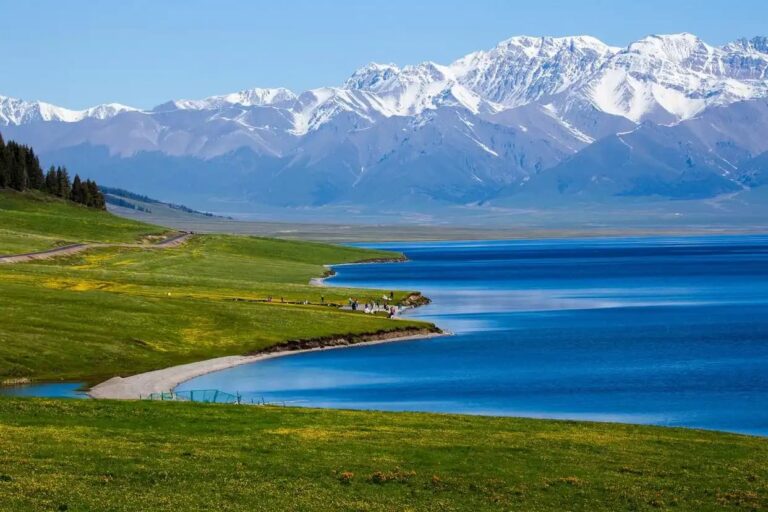
There is no railway station at the site, and public buses do not serve the rim, so a private car or rental is the practical choice. Many travelers encounter the canyon as a stop on the northern loop that continues to Sayram Lake and Yining, since the G30 and the Duku Highway corridor both pass within reach. Fuel up and stock water in Dushanzi, as services near the canyon are limited to a small ticket office and a few stalls.
Picking your window
Late spring through early autumn, from May to October, is the accessible season. Summer brings long, warm days and the greenest contrast between the red walls and the surrounding steppe, while September and October add golden light and cooler, clearer air that photographers prize. Winter closes some access roads with snow and ice, and the rim winds can be brutal, so plan accordingly.
The canyon faces roughly east-west, so the soft light of early morning and late afternoon brings out the stratification without washing it out. Midday sun flattens the relief, so time your visit for the edges of the day if you care about images. After rain the colors deepen to an almost saturated red, though the rim path can be slick, so tread carefully.
Sights, in order
Start at the main viewing platform, where the rim opens onto a sweeping bend of the gorge and you can read the geological layers like pages of a book. The exposed faces show millions of years of deposition, and the scale is best appreciated by walking a short stretch of the fenced path that follows the edge. Stay behind the barriers, as the ground near the lip is unstable in places.
Look for the side gullies, where smaller washes have cut intricate networks of miniature canyons that reward a zoom lens and patience. In the early season, melting snow feeds thin waterfalls that streak the walls, and raptors nest in the higher ledges. The contrast between the raw earth and the distant white Tianshan peaks behind it is the composition that draws most visitors back for a second look.
If you have time, drive the access road a little further to where the terrain opens into rolling grassland that meets the canyon’s north wall. This transition zone, from lush green to fractured red, is unique to this part of Xinjiang and makes a fine picnic stop away from the main crowd.
Things that smooth the way
Wear closed shoes with ankle support, since the rim is uneven and the loose scree can shift. Bring wind protection even on warm days, as the gorge funnels gusts that feel colder than the basin below. There is little shade, so a hat and sunscreen are essential in summer, and water is non-negotiable given the dry heat at altitude.
Tickets are modest and sold at the gate, but card readers can fail, so carry cash. Drones are restricted near some viewpoints, so check before launching. Because the site is exposed, avoid it during thunderstorms, when the open rim offers no shelter. Plan 60 to 90 minutes unless you are photographing seriously, in which case a sunset visit can easily double that.
Worth a detour
Dushanzi town is the birthplace of Xinjiang’s oil industry and has a modest petroleum heritage worth a short look. The route east continues to Urumqi, while the southwest connects via the Duku Highway to the Tianshan heart and then to the Ili Valley and Sayram Lake. If you are looping north, Karamay’s World Devil City lies a couple of hours away and offers a different flavor of wind-carved landscape to compare with Dushanzi’s water-carved walls.
How I’d wrap this up
Dushanzi Grand Canyon is proof that Xinjiang’s wonders are not all on the standard map. Quiet, free of crowds, and genuinely spectacular, it rewards the traveler who builds a little slack into the driving day. Bring your camera, watch your step at the edge, and let the red earth tell its long, slow story.